Tank Mountains facts for kids
Quick facts for kids Tank Mountains |
|
|---|---|
| Highest point | |
| Peak | Courthouse Mountain (33°12'10"N, 113°51:00"W) |
| Elevation | 735 m (2,411 ft) |
| Geography | |
| Country | United States |
| State | Arizona |
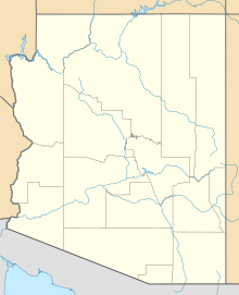
| Range coordinates | 33°09′32″N 113°42′27″W / 33.15889°N 113.70750°W |
The Tank Mountains are a mountain range in the Sonoran Desert in southwest Arizona. These mountains are also known as Hakimatava in the Yavapai language. They form part of the border of the Kofa National Wildlife Refuge.
Contents
About the Tank Mountains
The Tank Mountains stretch from east to west and are about 14 miles (23 km) long. The tallest point in the range is Courthouse Mountain. It stands at 2,411 feet (735 meters) high on the western side. Another peak, Black Dome, is also on the west end and reaches 2,236 feet (682 meters).
What are the Tank Mountains like?
The western two-thirds of these mountains are inside the Kofa National Wildlife Refuge. They connect to the Kofa Mountains through a place called Engesser Pass. The Kofa Butte, a notable peak, is located nearby.
Exploring the Area
The Tank Mountains are surrounded by interesting natural features. To the south, they meet the Palomas Mountains. These mountains are also partly within the wildlife refuge.
What is around the mountains?
North, east, and southeast of the Tank Mountains is a large flat area called the Palomas Plain. This plain slopes southeast towards Hyder and the Gila River valley. To the northeast, you can find the Little Horn Mountains and the Eagletail Mountains Wilderness. To the southwest is the King Valley, with the Castle Dome Mountains beyond it.
How to visit the Tank Mountains
The easiest ways to reach the Tank Mountains from the south and east are through Hyder. You can get to Hyder by passing through the towns of Dateland and Sentinel. These towns are located along Interstate 8.
 | Chris Smalls |
 | Fred Hampton |
 | Ralph Abernathy |


