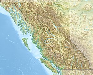
Tanzilla Plateau facts for kids
Quick facts for kids Tanzilla Plateau |
|
|---|---|
| Location | British Columbia |
| Coordinates | 58°22′00″N 130°22′00″W / 58.36667°N 130.36667°W |
| Part of | Stikine Plateau |
The Tanzilla Plateau is a special type of landform called a plateau. A plateau is like a large, flat tableland that sits high above the land around it. This particular plateau is found in the Stikine Country region of British Columbia, Canada. It's part of a bigger area called the Stikine Plateau.
The Tanzilla Plateau is located in an interesting spot. You can find it east of the Tuya River and north of the Stikine River. It also surrounds Dease Lake, which is a well-known lake in the area. To its east, the plateau gets close to the Stikine Ranges of the Cassiar Mountains, near Dark Mountain and Pyramid Mountain.
This plateau is surrounded by other similar landforms. To the southeast, you'll find the Spatsizi Plateau. The Klastline Plateau is to the south, and the Tahltan Highland is to the west and southwest. To the west and northwest, there's the Kawdy Plateau. All these areas are also smaller parts of the larger Stikine Plateau.
Parts of the Tanzilla Plateau
The Tanzilla Plateau includes some smaller mountain ranges within its boundaries. These are often called "subranges" because they are part of the larger plateau system.
- French Range
- Hotailuh Range
 | Janet Taylor Pickett |
 | Synthia Saint James |
 | Howardena Pindell |
 | Faith Ringgold |


