Te Atatū Peninsula facts for kids
Quick facts for kids
Te Atatū Peninsula
|
|
|---|---|
|
Suburb
|
|
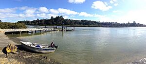
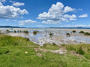
Taipari Strand, Te Atatū Peninsula
|
|
| Country | New Zealand |
| Local authority | Auckland |
| Electoral ward | Waitākere ward |
| Local board | Henderson-Massey Local Board |
| Area | |
| • Land | 546 ha (1,349 acre) |
| Population
(June 2023)
|
|
| • Total | 14,560 |
|
|
||
Te Atatū Peninsula is a suburb in West Auckland that sits right by the water. It's surrounded by the Waitematā Harbour. This area used to be home to brick factories and farms.
After the Northwestern Motorway was built in the 1950s, Te Atatū grew into a place with affordable homes. The part south of the motorway became known as Te Atatū South. For a long time, the Auckland Harbour Board wanted to build a port on the peninsula. When those plans were dropped, the land was turned into the Footrot Flats Fun Park, which was open in the 1980s. In the late 2010s, many new houses were built, and the population of Te Atatū grew a lot.
Contents
What is the Geography of Te Atatū Peninsula?
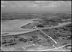
The Te Atatū Peninsula is about four kilometres long and two kilometres wide. It is surrounded by the Waitematā Harbour. The land is made of sandstone that formed on the ocean floor about 20 million years ago. On top of this is soil from ancient rivers.
The peninsula is bordered on the west by Te Wai-o-Pareira / Henderson Creek. To the east, it's bordered by the Whau River. Both of these are "drowned valleys," meaning they were river valleys that filled with water when sea levels rose. About 17,000 years ago, during the last ice age, sea levels were much lower. The peninsula was a high area above the Waitematā river valley then. The peninsula we see today formed about 6,500 years ago, when sea levels rose and the river valley became a harbour.
The peninsula is part of the Tāmaki Ecological District. Most of it is a "Warm Lowlands Ecosystem." This area originally had forests with tall trees like kauri, rimu, rātā, kahikatea, and rewarewa. The northern tip and the southwestern part near Henderson Creek have a "Harbour Coastline Ecosystem." This was once a diverse forest with trees like pōhutukawa, pūriri, and nīkau palms.
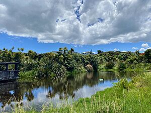
The saltmarsh on the eastern side of the peninsula is very important for native plants and birds. It connects to the Motu Manawa (Pollen Island) Marine Reserve to the southeast.
How Did Te Atatū Peninsula Get Its Name?
Early History and Land Use
The land of the peninsula belongs to the traditional area of Te Kawerau ā Maki. It is also important to Ngāti Whātua Ōrākei. Before Europeans arrived, Te Kawerau ā Maki had two villages here. They were called Ōrukuwai and Ōrangihina. These were named after ancestors Rukuwai and Rangihina. Rangihina was the wife of Te Au o Te Whenua, a very important chief of Te Kawerau ā Maki. To the southeast is Te Tōanga Waka. This was a portage on the Whau River, allowing canoes to travel between the Waitematā Harbour and the Manukau Harbour.
Thomas Henderson, a man from Scotland, bought land from Ngati Whatua in 1844. Around 1847, he started a timber mill on the banks of Te Wai-o-Pareira / Henderson Creek. This was to process kauri logs. During this time, Te Atatū Peninsula was known as Henderson Point.
In the 1880s, the peninsula's trees were cleared, and it became farmland. The northwestern side was where Māori farmers grew potatoes and kūmara (sweet potatoes). They also dug for kauri gum in the 1800s. The storage pits (rua) they made for potatoes led European settlers to call the peninsula "The Pits."
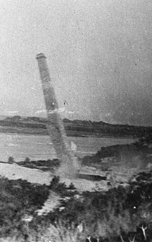
On March 12, 1894, Henderson Point was divided into smaller pieces and sold. Many of the buyers were the Māori families who already lived there. In the early 1900s, the area was renamed Te Atatū. This name means "the dawn." Reverend Thomas Jackson Bennett gave it this name because of the beautiful morning sunrises over the Waitematā Harbour. In the late 1800s and early 1900s, Te Atatū had two brick and pottery factories. One was by Henderson Creek, and another on the Whau River. The Henderson Brick and Tile Syndicate made bricks with a special backwards "S" design.
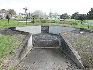
After the brick factories closed, the peninsula was mostly used for farming. Farmers raised dairy cows, pigs, and chickens. They also grew fruit for Auckland city. During World War II, gun emplacements were built on the eastern side of the peninsula. These were to protect the RNZAF Base Auckland at Hobsonville from possible attacks.
From Ports to Suburbs
In the 1940s, the Auckland Harbour Board suggested building a new port in the Waitematā Harbour. This would help ease the pressure on the Port of Auckland. In the early 1950s, the board bought Motumānawa / Pollen Island and 162 hectares of eastern Te Atatū for this plan. At the same time, the Northwestern Motorway was being built. This led to new housing developments on the peninsula, starting with the Ramlea Park Estate in the early 1950s. The motorway split the peninsula into two parts: Te Atatū North (now Te Atatū Peninsula) and Te Atatū South.
The population grew very quickly. Te Atatū was seen as an affordable place that was easy to get to from other parts of Auckland. The peninsula was divided into two main areas. The west became suburban housing. The east was set aside for factories and the planned port. Between 1945 and 1960, Te Atatū was the second fastest-growing area in Auckland. It was nicknamed "Nappy Valley" because so many young families moved there. It was a popular place for Urban Māori, Pākehā, and Pasifika families. However, the area's services and facilities struggled to keep up with the new residents. More affordable homes continued to be built in the 1960s and 1970s.
In the late 1960s, Te Atatū Peninsula was considered for a large gas-fired power plant. This plant was meant to make Auckland's power supply more reliable. But many people were against the plan. Over 1,000 people attended a meeting at Te Atatū Intermediate School in 1973. After this, Prime Minister Norman Kirk announced that the project would not go ahead.
Fun Park and Modern Growth
In the early 1980s, the Auckland Harbour Board gave up its plans for a port or industrial area on the peninsula. This meant the land could be used for other things. In 1982, Leisureland opened. It later became known as the Footrot Flats Fun Park. Other attractions like the Te Atatū Grand Prix Minicar Park also opened. The mayor of Waitemata City, Tim Shadbolt, liked the idea of the complex. He wanted the Waitemata City Council to develop the peninsula into a major entertainment area. This would bring more money for the council. The plans included conference centres and a proposed stadium called Kiwidome. But due to money problems, the park closed in 1989. The Waitakere City Council officially shut it down in 1991.
The name "Te Atatū Peninsula" became official on May 5, 1994. The Waitakere Council formally adopted it in 1997. However, "Te Atatu North" is still often used, especially by older people.
Te Atatū Peninsula saw another big period of growth in the late 2010s. Changes to the Auckland Unitary Plan led to many new townhouse developments. In 2024, construction will start on the Te Atatū busway station. This will be a stop on the Northwestern Busway, connecting Westgate to the Auckland City Centre. An urban marae (a traditional Māori meeting place) is planned for the Harbourview-Orangihina Park. The Auckland Council also plans to plant native trees in Harbourview-Orangihina Park. They also want to create a network of walking and cycling paths along the western side of the Whau River.
Who Lives in Te Atatū Peninsula?
Te Atatū Peninsula covers about 5.46 square kilometres. As of 2023, it had an estimated population of 14,454 people. This means there are about 2,647 people per square kilometre.
The population has been growing steadily:
- 2006: 11,688 people
- 2013: 12,486 people
- 2018: 13,344 people
- 2023: 14,454 people
In the 2023 New Zealand census, there were 14,454 people living here. This was an increase of 1,110 people (8.3%) since the 2018 census. The average age was 35.2 years. About 22.1% of people were under 15 years old.
People could choose more than one ethnic group. The results were:
English was spoken by 94.3% of people. The percentage of people born overseas was 30.4%.
When it came to religion, 54.3% of people said they had no religion. About 30.2% were Christian.
Of those aged 15 or older, 31.8% had a university degree or higher. The average income was $49,600. About 56.8% of people aged 15 or older were working full-time.
What Schools Are in Te Atatū Peninsula?
Te Atatū Peninsula has several schools for different age groups:
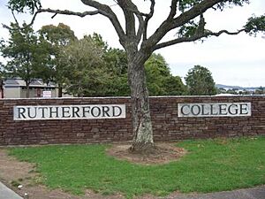
- Rutherford College is a high school for years 9–13. It has about 1,547 students. It is named after Ernest Rutherford.
- Te Atatū Intermediate School is for years 7–8. It has about 615 students.
There are also three primary schools for years 1–6:
- Peninsula Primary School (about 466 students)
- Matipo Primary School (about 504 students)
- Rutherford Primary School (about 477 students)
All these schools are coeducational, meaning both boys and girls attend.
What Parks and Reserves Are in Te Atatū Peninsula?
Harbourview-Orangihina Park is a large 85-hectare reserve along the coast of the Te Atatū Peninsula. This park has old anti-aircraft gun emplacements. These were built in 1943 because of worries about a Japanese invasion during World War II. Part of the park is used by the Te Atatū Pony Club. The park also contains the Semadeni residence, which is the oldest building still standing in Te Atatū Peninsula.
There are also several parks located further inland. The biggest one is Te Atatū Peninsula Park. This is a large sports field with a cycleway around it.
What Sports Clubs Are in Te Atatū?
Te Atatū is home to many sports clubs. One of the most successful is the Te Atatu Roosters rugby league team. They were national champions in 1988. They play at Jack Colvin Park.
Other sports clubs in the area include:
- Te Atatū Tennis Club
- Waitakere Cricket Club
- Waitakere rugby union club
- Waitemata Football Club
- Te Atatū Football Club
- West City Baseball Club
- Te Atatū softball club
- Waitemata Rowing Club
- Te Atatū Boating Club
 | Mary Eliza Mahoney |
 | Susie King Taylor |
 | Ida Gray |
 | Eliza Ann Grier |


