Terral, Oklahoma facts for kids
Quick facts for kids
Terral, Oklahoma
|
|
|---|---|
|
Town
|
|

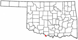
Location of Terral, Oklahoma
|
|
| Country | United States |
| State | Oklahoma |
| County | Jefferson |
| Post office | 1892 |
| Area | |
| • Total | 0.43 sq mi (1.10 km2) |
| • Land | 0.43 sq mi (1.10 km2) |
| • Water | 0.00 sq mi (0.00 km2) 0.0% |
| Elevation | 846 ft (258 m) |
| Population
(2020)
|
|
| • Total | 280 |
| • Density | 657.28/sq mi (253.88/km2) |
| Time zone | UTC-6 (CST) |
| • Summer (DST) | UTC-5 (CDT) |
| ZIP codes |
73561, 73569
|
| Area code(s) | 580 |
| FIPS code | 40-72900 |
| GNIS feature ID | 2413376 |
Terral is a small farming town in Jefferson County, Oklahoma, United States. In 2020, about 280 people lived there. The town is known for its agriculture, especially its delicious watermelons.
Contents
History of Terral
How Terral Started
Terral was founded in 1892 by a man named John Heidelberg Dace Terral. He came from Texas and leased land from a Chickasaw woman, Emily Colbert Fleetwood. John Terral and Hugh Schoolfield planned the town and started selling land lots in May 1892.
A post office was opened on August 8, 1892. John Terral himself was the first person in charge of the post office.
Farming in Terral
Since it began, Terral has always been a farming community. The most important crops grown here are watermelons, cantaloupes, and cotton. Raising animals like cattle and hogs is also a big part of the town's economy. These animals are usually sold in Fort Worth, Texas, which is about 90 miles (145 km) south of Terral.
To celebrate its farming roots, Terral started an annual event called the Terral Watermelon Jubilee in July 1965. It's a fun festival that celebrates the town's famous watermelons!
Where is Terral Located?
Terral is in the southern part of Jefferson County. It is located along U.S. Route 81. The town is about 20 miles (32 km) south of Waurika, which is the main town of the county. Terral is also just 1 mile (1.6 km) north of the Red River, which forms the border between Oklahoma and Texas.
The town covers a total area of about 1.1 square kilometers (0.43 square miles). All of this area is land.
Roads and Highways
 US 81 - This is a major highway that runs through Terral.
People of Terral
Population Changes Over Time
| Historical population | |||
|---|---|---|---|
| Census | Pop. | %± | |
| 1910 | 573 | — | |
| 1920 | 506 | −11.7% | |
| 1930 | 593 | 17.2% | |
| 1940 | 521 | −12.1% | |
| 1950 | 616 | 18.2% | |
| 1960 | 585 | −5.0% | |
| 1970 | 636 | 8.7% | |
| 1980 | 604 | −5.0% | |
| 1990 | 469 | −22.4% | |
| 2000 | 386 | −17.7% | |
| 2010 | 382 | −1.0% | |
| 2020 | 280 | −26.7% | |
| U.S. Decennial Census | |||
The number of people living in Terral has changed over the years. In 1910, there were 573 residents. The population reached its highest in 1970 with 636 people. By 2020, the population was 280.
Who Lives in Terral?
Based on information from the year 2000, there were 386 people living in Terral. These people lived in 173 households, and 102 of these were families.
- About 28.9% of households had children under 18 years old.
- 48.6% were married couples living together.
- About 19.7% of households had someone living alone who was 65 years old or older.
The average household had about 2.23 people, and the average family had about 2.97 people.
Age Groups
In 2000, the people in Terral were spread across different age groups:
- 25.9% were under 18 years old.
- 8.3% were between 18 and 24 years old.
- 21.2% were between 25 and 44 years old.
- 21.5% were between 45 and 64 years old.
- 23.1% were 65 years old or older.
The average age of people in Terral was 40 years.
Money and Income
In 2000, the average yearly income for a household in Terral was $15,972. For a family, the average income was $21,563. The average income per person in the town was $9,486.
About 27.7% of all people in Terral lived below the poverty line. This included 40.4% of those under 18 years old and 26.6% of those 65 or older.
See also
 In Spanish: Terral (Oklahoma) para niños
 | Jewel Prestage |
 | Ella Baker |
 | Fannie Lou Hamer |

