Terrigal Lagoon facts for kids
Quick facts for kids Terrigal Lagoon |
|
|---|---|
 |
|
| Location | Central Coast, New South Wales, Australia |
| Coordinates | 33°26′S 151°26′E / 33.433°S 151.433°E |
| Type | Intermittently closed intermediate saline coastal lagoon |
| Primary outflows | Tasman Sea of the South Pacific Ocean |
| Catchment area | 8.9 square kilometres (3.4 sq mi) |
| Basin countries | Australia |
| Surface area | 30 hectares (74 acres) |
| Average depth | 0.5 metres (1 ft 8 in) |
| Water volume | 151.2 megalitres (5.34×10⁶ cu ft) |
| Surface elevation | 0 m (0 ft) |
| Settlements | Terrigal, Wamberal |
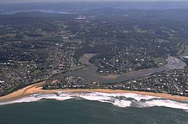
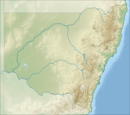
Terrigal Lagoon is a special type of water body called a coastal lagoon. It's found on the Central Coast of New South Wales, Australia. This lagoon is located between the towns of Terrigal and Wamberal. It's right next to the east coast, about 85 kilometers (53 miles) north of Sydney.
Terrigal Lagoon is an "intermittently closed" lagoon. This means it sometimes connects to the ocean and sometimes gets closed off by sand. Its water is salty, like the ocean.
Contents
About Terrigal Lagoon
Terrigal Lagoon covers an area of about 30 hectares (74 acres). A hectare is roughly the size of an international rugby field. The land area that drains water into the lagoon, called its catchment area, is about 8.9 square kilometers (3.4 square miles). When the lagoon is full, its water surface is around 29 hectares.
Where is the Lagoon?
A big part of the land around Terrigal Lagoon used to be farms, and most of the trees there have been cleared. Closer to the lagoon, you'll find many houses and buildings. The town of Terrigal is to the south and west of the lagoon. Part of the suburb of Wamberal is to the north.
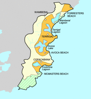
A large hill sits in the middle of the catchment area. This hill separates the two main parts, or "arms," of the lagoon. The North Arm of the lagoon collects water from an area of about 4.5 square kilometers (1.7 square miles). The West Arm collects water from about 3.7 square kilometers (1.4 square miles).
Other lagoons are also nearby. Wamberal Lagoon is to the north, and Avoca Lake is to the south. They are only a short distance away.
Studying the Lagoon
From 2005 to 2008, a team of scientists studied many waterways in the region. This study was led by Dr. John Marsdale from the University of Newcastle. Terrigal Lagoon was one of the places they investigated.
What Scientists Looked For
The research team checked many things in the lagoon. They looked at:
- How much sunlight reached the plants in the water.
- How clear the water was (called turbidity).
- How many plants and animals lived there.
- Levels of potassium, a chemical element.
- Oxygen levels in the water.
- The water's pH level, which tells if it's acidic or basic.
What They Found
The scientists discovered that things like sunlight and water quality really affected the living things in the lagoon. They noticed that less sunlight was reaching the smaller plants over time. This was because taller trees were growing and blocking the sun.
Dr. Marsdale's team also found high levels of potassium in the lagoon. These levels were much higher than in other nearby areas. The high potassium was causing problems for the fish and the many plants growing along the water's edge. The study also showed that there were fewer types of animals and some fish species living in the lagoon area.
 | George Robert Carruthers |
 | Patricia Bath |
 | Jan Ernst Matzeliger |
 | Alexander Miles |


