Territorial evolution of Arizona facts for kids
The following timeline shows how the State of Arizona in the United States changed its borders over time.
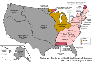
A map of the United States after the Constitution of the United States was approved on March 4, 1789.
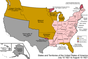
A map of the United States after the Treaty of Córdoba was signed on August 24, 1821.
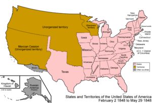
A map of the United States after the Treaty of Guadalupe Hidalgo was signed on February 2, 1848.
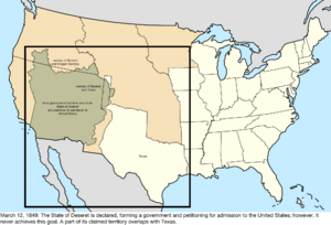
A map of the United States after the proposed State of Deseret was created on July 2, 1849.
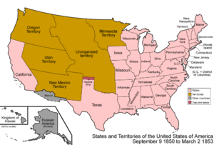
A map of the United States after the Territory of New Mexico and the Territory of Utah were created on September 9, 1850.
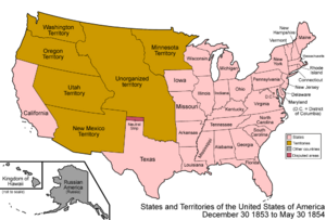
A map of the United States after the Gadsden Purchase on December 30, 1853.
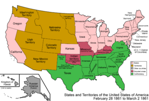
A map of the United States after the Territory of Colorado was created on February 28, 1861.
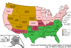
A map of the United States after the Confederate Territory of Arizona was created on February 24, 1862.
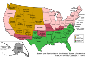
A map of the United States after the Territory of Arizona was created on June 19, 1862.
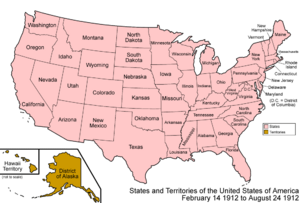
A map of the United States after Arizona became a state on February 14, 1912.
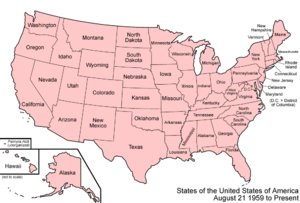
A map of the United States as it has been since Hawaiʻi became a state on August 21, 1959.
Contents
How Arizona's Borders Changed Over Time
Arizona's land has been part of many different countries and territories throughout history. This section explains how its borders changed.
Early Claims by Spain (Before 1821)
Before Mexico became independent, the land that is now Arizona was claimed by Spain.
- Nueva Vizcaya (1562–1821): A large Spanish area that included parts of what is now Arizona.
- Santa Fé de Nuevo Méjico (1598–1821): Another Spanish territory that covered some of Arizona.
- Sonora y Sinaloa (1732–1821): A Spanish region that also included parts of Arizona.
- End of Spanish Rule: In 1821, the Treaty of Córdoba was signed, and Mexico gained its independence from Spain. This meant Arizona's land was now part of Mexico.
Mexico's Control (1821–1853)
After gaining independence, Mexico controlled the land that would become Arizona.
- Santa Fé de Nuevo México (1821–1848): This Mexican territory continued to cover parts of Arizona.
- Sonora y Sinaloa (1824–1830): This area was also part of Mexico.
- Sonora (since 1830): After 1830, the region was known simply as Sonora.
- Mexican-American War: The Mexican–American War ended in 1848 with the Treaty of Guadalupe Hidalgo. Through this treaty, Mexico gave a large amount of land, including much of present-day Arizona, to the United States.
- Gadsden Purchase (1853): The U.S. bought more land from Mexico in 1853, known as the Gadsden Purchase. This completed the southern border of Arizona as we know it today.
Arizona Becomes Part of the United States
After the land became part of the U.S., it went through several stages before becoming a state.
Unorganized Territory (1848–1850)
- Right after the Treaty of Guadalupe Hidalgo in 1848, the land was "unorganized." This means it wasn't yet set up as a formal U.S. territory or state.
- The Compromise of 1850 helped decide how these new lands would be organized.
The State of Deseret (1849–1850)
- For a short time, a group of settlers tried to create their own area called the State of Deseret. This was not officially recognized by the U.S. government.
New Mexico Territory (1850–1912)
- In 1850, the New Mexico Territory was officially created. It included most of what is now Arizona.
- The Gadsden Purchase in 1853 added more land to this territory, making the southern border of Arizona.
The American Civil War (1861–1865)
- During the American Civil War, some people in the southern part of the New Mexico Territory sided with the Confederate States of America. They formed their own area called the Arizona Territory (CSA) from 1861 to 1865.
Arizona Territory (1863–1912)
- In 1863, the U.S. government officially created the Arizona Territory. This separated it from the New Mexico Territory.
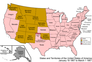
- In 1867, a small part of northwestern Arizona was moved and became part of the State of Nevada.
Arizona Becomes a State (1912)
- Finally, on February 14, 1912, Arizona officially became the 48th state in the Union.
Small Border Changes (After 1912)
- Even after becoming a state, there were a few minor border adjustments. In 1927, due to changes in the Colorado River, the U.S. gained two small pieces of land, called "bancos," from Mexico along the Arizona border.
Black History Month on Kiddle
African-American Women in Medicine:
 | Mary Eliza Mahoney |
 | Susie King Taylor |
 | Ida Gray |
 | Eliza Ann Grier |

All content from Kiddle encyclopedia articles (including the article images and facts) can be freely used under Attribution-ShareAlike license, unless stated otherwise. Cite this article:
Territorial evolution of Arizona Facts for Kids. Kiddle Encyclopedia.

