Tesnus, Texas facts for kids
Quick facts for kids
Tesnus, Texas
|
|
|---|---|
| Country | United States |
| State | Texas |
| County | Brewster |
| Elevation | 3,720 ft (1,134 m) |
| Time zone | UTC-6 (Central (CST)) |
| • Summer (DST) | UTC-5 (CDT) |
| ZIP codes |
79843
|
| Area code | 432 |
| GNIS feature ID | 1379153 |
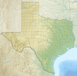
Tesnus is a ghost town and unincorporated community located in Brewster County, Texas. A ghost town is a place where most or all people have left, often because the main reason for the town's existence, like a mine or a railroad stop, is no longer there. Tesnus is found in the southwestern part of Texas.
Contents
History of Tesnus
Tesnus was first planned in 1882. This happened when the Southern Pacific Railroad built its tracks to that spot. The name "Tesnus" is actually "sunset" spelled backwards. It was chosen because a picture of a sunset was part of the Southern Pacific Railroad's logo.
A post office opened in Tesnus in 1912. It served the community for many years. However, the post office eventually closed down in 1954. After that, fewer people lived in Tesnus, and it became a ghost town.
Understanding Tesnus Geology
Tesnus, Texas, is very important in the world of geology. It gives its name to a special geological formation called the Tesnus Formation or Tesnus Shale. A geological formation is a specific layer of rock that has unique features.
What is the Tesnus Formation?
The rocks around Tesnus are the main example of the Tesnus Formation. Scientists study these rocks to learn more about this formation. The Tesnus Formation formed a very long time ago, during the Upper Mississippian and Lower Pennsylvanian periods.
This rock layer is mostly made up of different kinds of rock. These include olive-drab to black shale, siltstone, and fine-grained sandstone. Shale is a soft rock made from mud. Siltstone is similar but made from slightly larger particles. Sandstone is made from sand grains.
Exploring the Rock Layers
The thickness of the Tesnus Formation changes across the area. In the eastern Marathon Uplift, it can be as thick as 2,000 meters (about 6,560 feet). But as you go west, it gets much thinner, down to about 100 meters (about 330 feet).
The bottom part of the Tesnus Formation in the east is a thick layer of shale. This shale layer makes up the entire formation in the western areas. The sandstone layers within the formation can be up to 5 meters (about 16 feet) thick. However, most of these layers are between 30 and 150 centimeters (about 12 to 59 inches) thick.
Fossils and Ancient Life
Sometimes, the shale in the Tesnus Formation contains pieces of ancient plants. These include carbon-rich plant fragments and tiny spores. Some sandstone beds even have fossilized wood pieces, up to 30 centimeters (about 12 inches) long.
Scientists have also found rare fossils of tiny sea creatures. These include conodonts, radiolaria, sponge spicules, a type of crustacean, and simple brachiopods. These fossils help us understand what life was like millions of years ago.
How the Tesnus Formation Was Created
The rocks of the Tesnus Formation were formed from sediments. These sediments gathered deep in the ocean, in areas called submarine fans and channels. Think of these as underwater rivers that carry sand and mud far out to sea.
These sediments mostly came from the southeast. They likely came from a large piece of land, called a continental terrane, that was moving closer. This landmass later crashed into North America. This huge collision is known as the Ouachita orogeny. This event also created the Ouachita Mountains in Arkansas and Oklahoma. The rocks of the Tesnus Formation were pushed and folded by this powerful collision.
 | Dorothy Vaughan |
 | Charles Henry Turner |
 | Hildrus Poindexter |
 | Henry Cecil McBay |


