Tetuán, Utuado, Puerto Rico facts for kids
Quick facts for kids
Tetuán
|
|
|---|---|
|
Barrio
|
|

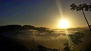
Sunrise as seen from Finca Vista Bella, a winery in Tetuán
|
|

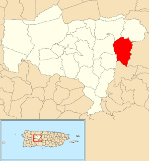
Location of Tetuán within the municipality of Utuado shown in red
|
|
| Commonwealth | |
| Municipality | |
| Area | |
| • Total | 5.46 sq mi (14.1 km2) |
| • Land | 5.46 sq mi (14.1 km2) |
| • Water | 0 sq mi (0 km2) |
| Elevation | 2,096 ft (639 m) |
| Population
(2010)
|
|
| • Total | 680 |
| • Density | 124.5/sq mi (48.1/km2) |
| Source: 2010 Census | |
| Time zone | UTC−4 (AST) |
Tetuán is a small area, like a neighborhood, located in the town of Utuado, Puerto Rico. In 2010, about 680 people lived there. It's one of the many interesting places in Puerto Rico.
A Look Back: Tetuán's History
After the Spanish–American War ended in 1898, Spain gave Puerto Rico to the United States. This agreement was part of the Treaty of Paris of 1898. Puerto Rico then became an unincorporated territory of the U.S. This means it is part of the U.S. but does not have all the same rights as a state.
In 1899, the United States Department of War counted all the people in Puerto Rico. This count is called a census. The census found that 1,678 people lived in Tetuán barrio at that time.
| Historical population | |||
|---|---|---|---|
| Census | Pop. | %± | |
| 1900 | 1,678 | — | |
| 1980 | 747 | — | |
| 1990 | 617 | −17.4% | |
| 2000 | 756 | 22.5% | |
| 2010 | 680 | −10.1% | |
| U.S. Decennial Census 1899 (shown as 1900) 1910-1930 1930-1950 1980-2000 2010 |
|||
Natural Events: Landslides in Tetuán
A landslide happens when a lot of rock, earth, or debris slides down a slope. On May 28, 2019, a landslide happened in Tetuán. This event blocked the main road, Puerto Rico Highway 140. Because of this, many families could not reach the road.
The mayor of Utuado explained that landslides are common in the Utuado area. This is because of the region's hilly landscape and heavy rainfall.
See also
 In Spanish: Tetuán (Utuado) para niños
- List of communities in Puerto Rico
 | Roy Wilkins |
 | John Lewis |
 | Linda Carol Brown |


