Texhoma, Oklahoma facts for kids
Quick facts for kids
Texhoma, Oklahoma
|
|
|---|---|

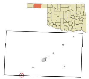
Location within Texas County, Oklahoma.
|
|
| Country | United States |
| State | Oklahoma Texas |
| County | Texas |
| Incorporated | 1908 |
| Area | |
| • Total | 0.64 sq mi (1.66 km2) |
| • Land | 0.64 sq mi (1.66 km2) |
| • Water | 0.00 sq mi (0.00 km2) |
| Elevation | 3,487 ft (1,063 m) |
| Population
(2020)
|
|
| • Total | 596 |
| • Density | 1,335.41/sq mi (515.55/km2) |
| Time zone | UTC-6 (Central (CST)) |
| • Summer (DST) | UTC-5 (CDT) |
| ZIP code |
73949
|
| Area code | 580 |
| FIPS code | 40-73100 |
| GNIS feature ID | 2413378 |
| Website | texhoma.us |
Texhoma is a small town in Texas County, Oklahoma, USA. In 2020, about 596 people lived there. It's a special place because it's split by the border between Texas and Oklahoma! There's also a town called Texhoma in Texas right next door.
The name "Texhoma" comes from combining "Texas" and "Oklahoma." This town started because the Rock Island Railroad laid tracks through the area. Today, much of the town's money comes from ranching and raising animals.
Contents
The Story of Texhoma
Before 1890, the area now known as the Oklahoma Panhandle was mostly open land for ranches. It was called "No Man's Land" because no state or territory officially owned it.
How the Town Began
After 1890, people could claim land there. Many cowboys claimed land near the CCC Ranch. They would then sell it to the ranch once they officially owned it.
The Rock Island Railroad helped the town grow. They were building train tracks from Liberal, Kansas to Santa Rosa, New Mexico. This brought more people to the area.
Name Changes and Growth
A post office opened on May 7, 1898, and was first named Loretta. In 1901, the post office moved and changed its name to Texhoma. This new name showed that the town was right on the state line.
More people moved to Texhoma once the railroad was built. The town quickly grew to almost 1,000 people. It became the closest train town for people living far away. This included areas as far north as Boise City and south into the Texas Panhandle.
Border Changes
In 1932, a new survey moved the state border about 365 feet south. This meant that most of the businesses in Texhoma, Texas actually moved into the Oklahoma side of the town.
Where Texhoma Is Located
Texhoma is located at 36°30′16″N 101°47′11″W / 36.50444°N 101.78639°W. It covers about 0.6 square miles (1.6 square kilometers) of land. There is no water area within the town limits.
People of Texhoma
In 2020, 596 people lived in Texhoma. There were 302 households, which are groups of people living in one home.
Population Changes Over Time
The number of people living in Texhoma has changed over the years:
- 1910: 372 people
- 1920: 687 people
- 1930: 819 people
- 1940: 577 people
- 1950: 1464 people
- 1960: 911 people
- 1970: 921 people
- 1980: 785 people
- 1990: 746 people
- 2000: 935 people
- 2010: 926 people
- 2020: 596 people
Who Lives in Texhoma
About 81.6% of the people in Texhoma are White. About 14.76% are from other races. About 31.76% of the population is Hispanic or Latino.
The average age in Texhoma is 32 years old. About 31.2% of the people are under 18 years old.
Learning in Texhoma
Students in Texhoma, both from Texas and Oklahoma, go to school together. This is a special setup between the two states.
School System
- Kids in kindergarten through fourth grade go to school in Texas. This is the Texhoma Independent School District Texhoma Independent School District.
- Students in fifth through twelfth grade go to school in Oklahoma. This is Texhoma Public Schools.
Texhoma is the only city in Oklahoma where high school graduates can attend public universities in either Oklahoma or Texas. They can pay the lower in-state tuition rates for both states.
Getting Around Texhoma
Texhoma is served by two main roads:
- State Highway 95 runs north to the Kansas state line.
- U.S. Highway 54 also passes through the town.
Airports and Train Service
- There is a small local airport called Texhoma Municipal Airport (FAA ID: K49).
- A larger airport, Guymon Municipal Airport (KGUY), is about 22 miles northeast.
- For bigger flights, people can go to Liberal Mid-America Regional Airport in Liberal, Kansas, about 62 miles away.
- The Rick Husband Amarillo International Airport is about 110 miles south.
- Train service for goods is provided by the Union Pacific Railroad.
Interesting Places to See
- The Texhoma High School buildings are unique. They are housed in two monolithic dome structures, which are strong, round buildings.
Historic Sites Nearby
Several places near Texhoma are listed on the National Register of Historic Places. This means they are important historical sites.
- CCC (Three C) Ranch Headquarters (Osborn Homestead) (west of Texhoma)
- Penick House (218 N. East St.)
- Johnson-Cline Archaeological Site
Famous People from Texhoma
- Patience Latting was the mayor of Oklahoma City from 1971 to 1983.
See also
 In Spanish: Texhoma (Oklahoma) para niños

