Santa Rosa, New Mexico facts for kids
Quick facts for kids
Santa Rosa, New Mexico
|
|
|---|---|
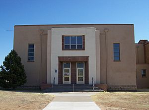
New wing, Guadalupe County Courthouse
|
|
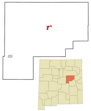
Location of Santa Rosa, New Mexico
|
|
| Country | United States |
| State | New Mexico |
| County | Guadalupe |
| Named for | Rose of Lima |
| Area | |
| • Total | 5.02 sq mi (13.01 km2) |
| • Land | 5.00 sq mi (12.95 km2) |
| • Water | 0.03 sq mi (0.06 km2) |
| Elevation | 4,567 ft (1,392 m) |
| Population
(2020)
|
|
| • Total | 2,850 |
| • Density | 570.11/sq mi (220.13/km2) |
| Time zone | UTC-7 (Mountain (MST)) |
| • Summer (DST) | UTC-6 (MDT) |
| ZIP code |
88435
|
| Area code(s) | 575 |
| FIPS code | 35-70670 |
| GNIS feature ID | 2411828 |
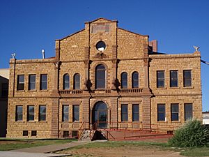
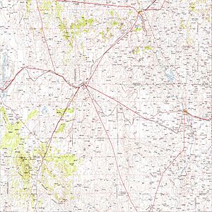
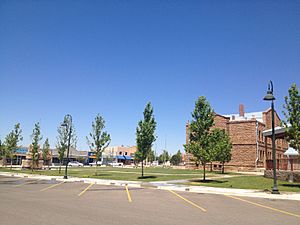
Santa Rosa is a city in New Mexico, United States. It is the main town of Guadalupe County. In 2020, about 2,850 people lived there. Santa Rosa is located between two larger cities, Albuquerque and Tucumcari. It sits by the Pecos River, where major highways like Interstate 40 and U.S. Route 54 meet. The city is on the western edge of a flat area called the Llano Estacado.
Contents
History
The first European settlement in this area started in 1865. It was called Agua Negra Chiquita, which means "Little Black Water" in Spanish. In 1890, the name changed to Santa Rosa. This name means "Saint Rose" in Spanish. Don Celso Baca, who founded the city, built a chapel and named it after his mother, Rosa, and Saint Rose of Lima. The name "Rosa" might also refer to the roses in the story of Our Lady of Guadalupe. This shows the strong Catholic faith of the Spanish settlers who came to the area.
Around the year 1900, Santa Rosa was not the biggest town nearby. Puerto de Luna, about ten miles south, was the main town for Guadalupe County. Santa Rosa grew larger after 1901. This was when the Chicago, Rock Island & Pacific Railroad reached Santa Rosa from the east. Soon after, in 1902, the El Paso and Northeastern Railway arrived from the southwest. These two railroads connected in Santa Rosa, making it an important stop. Because of this, a busy community quickly grew. In 1903, Santa Rosa became the county seat, taking over from Puerto de Luna.
In 1926, the main east-west road through Santa Rosa became U.S. Route 66. More cars traveling through made the town a popular place to stop. Many motels and cafes opened. Santa Rosa's part of Route 66 is famous in movies. When the book The Grapes of Wrath was made into a movie, the director John Ford filmed a scene in Santa Rosa. In the movie, Tom Joad (Henry Fonda) watches a train cross the Pecos River bridge. Santa Rosa was also a filming location for Bobbie Jo and the Outlaw, which starred Lynda Carter.
The famous author Rudolfo Anaya grew up in Santa Rosa. His book Bless Me, Ultima is based on the fictional town of Guadalupe, which is inspired by Santa Rosa.
Geography
Santa Rosa has many natural lakes, which is unusual for a dry desert area. These lakes are actually sinkholes. Sinkholes form when the ground above an underground cave collapses. The lakes are filled with water and are connected by hidden tunnels underground. The most famous lake is Blue Hole. It's a popular place for diving. The water is cool, about 61 degrees Fahrenheit (16 degrees Celsius), and the lake is over 81 feet (25 meters) deep.
Santa Rosa is located near the middle of Guadalupe County. The city covers about 5 square miles (12.9 square kilometers). Only a small part of this area, about 0.03 square miles (0.07 square kilometers), is water.
Climate
Santa Rosa has a semi-arid climate. This means it's usually dry, but not a true desert.
| Climate data for Santa Rosa, New Mexico | |||||||||||||
|---|---|---|---|---|---|---|---|---|---|---|---|---|---|
| Month | Jan | Feb | Mar | Apr | May | Jun | Jul | Aug | Sep | Oct | Nov | Dec | Year |
| Mean daily maximum °F (°C) | 53.5 (11.9) |
58.2 (14.6) |
64.9 (18.3) |
73.6 (23.1) |
81.6 (27.6) |
90.4 (32.4) |
91.9 (33.3) |
90.0 (32.2) |
84.3 (29.1) |
74.9 (23.8) |
62.6 (17.0) |
54.3 (12.4) |
73.3 (22.9) |
| Mean daily minimum °F (°C) | 24.8 (−4.0) |
27.5 (−2.5) |
32.7 (0.4) |
40.5 (4.7) |
49.3 (9.6) |
58.1 (14.5) |
62.7 (17.1) |
61.2 (16.2) |
53.8 (12.1) |
42.5 (5.8) |
31.7 (−0.2) |
25.7 (−3.5) |
42.5 (5.8) |
| Average precipitation inches (mm) | 0.39 (9.9) |
0.44 (11) |
0.64 (16) |
0.80 (20) |
1.54 (39) |
1.56 (40) |
2.31 (59) |
2.60 (66) |
1.64 (42) |
1.26 (32) |
0.52 (13) |
0.60 (15) |
14.31 (363) |
| Average snowfall inches (cm) | 2.9 (7.4) |
2.5 (6.4) |
1.0 (2.5) |
0.6 (1.5) |
0.1 (0.25) |
0.0 (0.0) |
0.0 (0.0) |
0.0 (0.0) |
0.0 (0.0) |
0.3 (0.76) |
1.3 (3.3) |
4.0 (10) |
12.6 (32) |
| Source: WRCC | |||||||||||||
Getting Around Santa Rosa
Highways
Interstate 40 runs through Santa Rosa with three exits. This highway goes east about 59 miles (95 km) to Tucumcari and west about 115 miles (185 km) to Albuquerque. U.S. Route 84 goes southeast about 44 miles (71 km) to Fort Sumner. U.S. Route 54 goes southwest about 40 miles (64 km) to Vaughn.
The main east-west road in the city is still called "Route 66". This is because it used to be part of the famous U.S. Route 66, even though that highway officially changed in 1985. New Mexico State Road 91 goes south to Puerto de Luna.
Railroad
Union Pacific provides train service for cargo. There have been no passenger trains since 1968.
Airport
The Santa Rosa Route 66 Airport is located east of the city. It does not have regular passenger flights.
People of Santa Rosa
| Historical population | |||
|---|---|---|---|
| Census | Pop. | %± | |
| 1920 | 1,093 | — | |
| 1930 | 1,127 | 3.1% | |
| 1940 | 2,310 | 105.0% | |
| 1950 | 2,199 | −4.8% | |
| 1960 | 2,220 | 1.0% | |
| 1970 | 2,485 | 11.9% | |
| 1980 | 2,469 | −0.6% | |
| 1990 | 2,263 | −8.3% | |
| 2000 | 2,744 | 21.3% | |
| 2010 | 2,848 | 3.8% | |
| 2020 | 3,007 | 5.6% | |
| U.S. Decennial Census | |||
In 2000, there were 2,744 people living in Santa Rosa. There were 898 households, and 616 of them were families. The city had about 646 people per square mile (249 people per square kilometer).
About 35% of households had children under 18 living with them. About 45% were married couples. Around 18% had a female head of household with no husband present. About 28% of households were single people. About 11% of people lived alone and were 65 or older. The average household had 2.5 people.
The population was spread out by age:
- 23.1% were under 18
- 10.4% were 18 to 24
- 34.4% were 25 to 44
- 20.0% were 45 to 64
- 12.0% were 65 or older
The average age in the city was 36 years old. For every 100 females, there were about 135 males. Most people in Santa Rosa identified as Hispanic or Latino, making up over 81% of the population.
Education
Santa Rosa has its own school district called Santa Rosa Consolidated Schools. This district includes Santa Rosa Elementary School, Santa Rosa Middle School, and Santa Rosa High School.
Sports
The football team at Santa Rosa High School is very successful. They won three state championships in a row in 2010, 2011, and 2012. In 2010 and 2011, they beat teams that had not lost a game until the championship. In 2012, the Santa Rosa Lions went undefeated and won the championship against the Tularosa Wildcats. The Lions also won championships in 1955, 1993, 1996, 1998, and 2007. Santa Rosa High School was also one of the first schools in the country to start a lawn mower racing club!
Notable People
- Anarquia, a professional wrestler
- Rudolfo Anaya, an author famous for Bless Me, Ultima
- Charles E. Barnhart, a lawyer and politician
- Dave Campos, a motorcycle racer
- Joe A. Campos, a former member of the New Mexico House of Representatives
- Santiago E. Campos, a lawyer and judge
- George Dodge, a former member of the New Mexico House of Representatives
- Miguel Marquez, a national news reporter for CNN
- Lucy Scarbrough, a well-known pianist, conductor, and teacher.
See also
 In Spanish: Santa Rosa (Nuevo México) para niños
 | May Edward Chinn |
 | Rebecca Cole |
 | Alexa Canady |
 | Dorothy Lavinia Brown |


