
The Narrows (Pennsylvania) facts for kids

The Narrows is a special place in Bedford County, Pennsylvania. It's a "water gap," which means a river has cut through a mountain. Here, the Raystown Branch of the Juniata River flows right through Evitts Mountain.
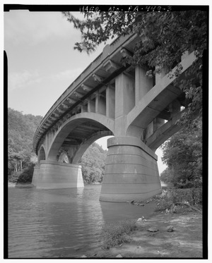
This natural passage is very important for travel. Two major roads, U.S. Route 30 (also known as the Lincoln Highway) and the Pennsylvania Turnpike, both go through The Narrows. The area is located within two local government areas called townships: Snake Spring and Bedford.
How The Narrows Was Formed
The Narrows was created by two main things working together over a very long time. First, there are many large cracks in the Earth's crust here, called faults. These faults run from east to west. Second, the powerful Raystown Branch of the Juniata River slowly wore away the rock. This wearing-down process is called erosion. Together, the faults and the river's erosion carved out this amazing water gap.
Layers of Rock You Can See
If you look closely at the sides of The Narrows, you can see different layers of rock. These layers are called "formations" by geologists. On the north side, along the Pennsylvania Turnpike, you can see four main rock formations:
- The Tuscarora
- The Juniata
- The Bald Eagle
- The Reedsville Formation
The Tuscarora formation is also visible on the south side of The Narrows, along U.S. Route 30. These rock layers tell a story about how the Earth changed over millions of years.

