The Pinery, Colorado facts for kids
Quick facts for kids
The Pinery, Colorado
|
|
|---|---|

Entrance sign at North Pinery Parkway and State Highway 83.
|
|

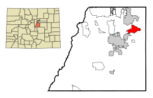
Location of The Pinery CDP in Douglas County, Colorado.
|
|
| Country | |
| State | |
| County | Douglas County |
| Government | |
| • Type | unincorporated community |
| Area | |
| • Total | 10.416 sq mi (26.978 km2) |
| • Land | 10.379 sq mi (26.882 km2) |
| • Water | 0.037 sq mi (0.096 km2) |
| Elevation | 6,066 ft (1,849 m) |
| Population
(2020)
|
|
| • Total | 11,311 |
| • Density | 1,085.90/sq mi (419.268/km2) |
| Time zone | UTC-7 (MST) |
| • Summer (DST) | UTC-6 (MDT) |
| ZIP Code |
Parker 80134
|
| Area codes | 303 & 720 |
| GNIS feature | The Pinery, Colorado |
The Pinery is a special kind of community in Douglas County, Colorado, United States. It's called an "unincorporated community" because it doesn't have its own city government. Instead, it's managed by Douglas County. It's also a "census-designated place" (CDP), which means the U.S. Census Bureau counts its population separately.
The Pinery is part of the larger Denver–Aurora–Lakewood, CO Metropolitan Statistical Area. This is a big area where many cities and towns are connected. In 2020, about 11,311 people lived in The Pinery. The local Parker post office handles mail for the area.
Contents
Where is The Pinery Located?
The Pinery is in a great spot in Colorado. To its north, you'll find the town of Parker. To the southwest, it borders Castle Rock, which is the main town of Douglas County.
Key Roads and Travel
Colorado State Highway 83 runs right through the middle of The Pinery. This highway makes it easy to get around.
- It goes north about 4 miles to the center of Parker.
- It goes south about 4 miles to Franktown.
- From Franktown, you can travel about 11 miles southwest to reach the center of Castle Rock.
Size of The Pinery
The Pinery covers an area of about 26.98 square kilometers (that's about 10.42 square miles). Most of this area is land, but a small part, about 0.096 square kilometers (0.037 square miles), is water.
How Many People Live Here?
The United States Census Bureau keeps track of how many people live in places like The Pinery. They first counted The Pinery as a CDP in 1990.
| The Pinery CDP, Colorado | ||
|---|---|---|
| Year | Pop. | ±% |
| 1990 | 4,885 | — |
| 2000 | 7,253 | +48.5% |
| 2010 | 10,517 | +45.0% |
| 2020 | 11,311 | +7.5% |
| Source: United States Census Bureau | ||
As you can see from the numbers, the population of The Pinery has grown quite a bit over the years!
Schools in The Pinery
Students living in The Pinery attend schools that are part of the Douglas County School District RE-1. This school district serves many communities in Douglas County, making sure kids have access to education.
See also
 In Spanish: The Pinery para niños


