The Roads facts for kids
Quick facts for kids
The Roads
|
|
|---|---|
|
Neighborhood of Miami
|
|

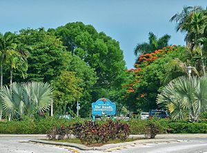
Entrance to The Roads neighborhood
|
|

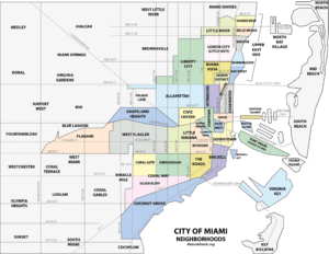
The Roads neighborhood within the City of Miami
|
|
| Country | United States |
| State | Florida |
| County | Miami-Dade County |
| City | Miami |
| Elevation | 13 ft (4 m) |
| Population
(2010)
|
|
| • Total | 7,327 |
| • Density | 12,687/sq mi (4,898/km2) |
| Time zone | UTC-05 (EST) |
| ZIP Code |
33129
|
| Area code(s) | 305, 786 |
| Website | The Roads Association |
The Roads is a special neighborhood in Miami, Florida. It's known for its unique street layout. The area is shaped like a triangle. You can find it just west of Brickell.
This neighborhood is famous for its older homes and schools. It also has many streets covered by trees. Even though it's close to Downtown and Brickell, The Roads is mostly a quiet place where people live. Its streets are different from the rest of Miami. They are all called "roads" instead of "streets" or "avenues." A group called the Miami Roads Neighborhood Civic Association has helped the area since 1986.
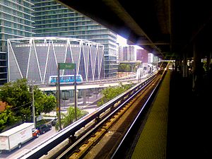
You can get to The Roads using the Miami Metrorail. The Vizcaya station is to the south, and the Brickell station is to the north.
Contents
History of The Roads Neighborhood
The Roads was first called "Brickell Hammock." It was planned and built by Mary Brickell. She finished designing it in January 1922, just before she passed away. Mary Brickell wanted The Roads to be a friendly place for people to walk. She designed wide streets with green areas in the middle. There were also roundabouts with plants native to Miami.
Mary Brickell gave the streets, sidewalks, and electric lights to the City of Miami in 1922. All the properties in The Roads were sold very quickly. They were all bought on a single day, February 1, 1923. At first, the homes were meant to be affordable for everyone in Miami. But The Roads quickly became one of Miami's most popular neighborhoods. It was soon known as a very fancy place to live.
Understanding The Roads' Unique Layout
The Roads is located at 25°45′22″N 80°12′18″W / 25.756°N 80.205°W. It is about 13 feet (4 meters) above sea level. This makes it one of the higher spots in Miami.
What makes The Roads really special is its "off-grid" design. Most streets in Miami-Dade County follow a grid pattern. This means streets run east-west, and avenues run north-south. But in The Roads, the main streets are tilted. They are about 45 degrees off from the usual grid. This means the "avenues" here run northeast-southwest. This is different from the standard north-south direction found elsewhere.
This unique layout can sometimes be confusing. For example, when Coral Way (which is usually SW 3rd Avenue) crosses SW 12th Avenue, it suddenly turns. It becomes SW 22nd Street because of the angle change. This is a well-known example of how the streets change names in this area.
Getting Around The Roads
The Roads neighborhood has good public transportation. You can use Metrobus services all around the area. The Miami Metrorail also serves the neighborhood at two stations:
- Brickell (located at SW 11th Street and SW 1st Avenue)
- Vizcaya (located at SW 32nd Road and U.S. 1)
The Metrorail system connects to many places in Miami. You can reach Greater Miami and the Miami International Airport. It also connects to all Miami-Dade County bus lines, Tri-Rail, and Amtrak. The main bus station in Downtown Miami is near the Arsht Center.
Schools in The Roads
Miami-Dade County Public Schools manages the public schools in the area.
Private Schools in The Roads
- Beth David Religious School
- Lincoln Marti School
- St. Peter and Paul
Parks and Green Spaces
The Roads neighborhood is close to several beautiful parks and nature areas:
- Simpson Park Hammock - This is a nature preserve. You can find it at S. Miami Ave and Broadway.
- Alice Wainwright Park - Another nature preserve. It's located at Brickell Ave and the Rickenbacker Causeway.
- Vizcaya Museum and Gardens - A famous museum and garden. It's at 3251 S Miami Ave.
 | Kyle Baker |
 | Joseph Yoakum |
 | Laura Wheeler Waring |
 | Henry Ossawa Tanner |


