The Rock, Georgia facts for kids
Quick facts for kids
The Rock, Georgia
|
|
|---|---|
| Country | United States |
| State | Georgia |
| County | Upson |
| Elevation | 823 ft (251 m) |
| Time zone | UTC-5 (Eastern (EST)) |
| • Summer (DST) | UTC-4 (EDT) |
| ZIP code |
30285
|
| Area code(s) | 706 |
| GNIS feature ID | 333213 |
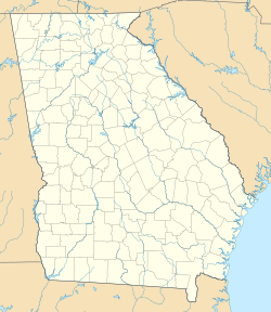
The Rock is a small place in Upson County, Georgia, United States. It is known as an unincorporated community, meaning it does not have its own local government like a city. It is also a census-designated place, which is an area the government defines for counting people.
The Rock is located about 7 miles (11 km) northeast of Thomaston on Georgia State Route 36. It has its own post office with ZIP code 30285. A popular spot in the area is The Rock Ranch, which is a fun theme park with a farming theme. The Rock is surrounded by other towns like Barnesville, Hannahs Mill, Meansville, and Yatesville.
Contents
History of The Rock
When Was The Rock Established?
The community of The Rock got its name from a special rock formation nearby. A post office was first opened here in 1853.
The Rock's Town Status
In 1877, the Georgia General Assembly officially made The Rock a town. This meant it had its own local government. However, in 1995, the town's official status was removed. This is why it is now an unincorporated community.
Railroad History in The Rock
A very important railroad line came through The Rock in 1847. It was built by the Central of Georgia Railway and connected Thomaston to Barnesville. Over the years, different railway companies took over this line.
- In 1963, the Southern Railway (U.S.) bought the Central of Georgia.
- Later, in 1982, the Southern Railway joined with another company to form the Norfolk Southern Railway. This new company then owned the railroad line in The Rock.
- Since 2016, a company called CaterParrot Railnet has been operating the line.
Population Changes in The Rock
How Many People Live in The Rock?
The number of people living in The Rock has changed over many years. The U.S. Census counts the population every ten years.
| Historical population | |||
|---|---|---|---|
| Census | Pop. | %± | |
| 1900 | 180 | — | |
| 1910 | 188 | 4.4% | |
| 1920 | 181 | −3.7% | |
| 1930 | 171 | −5.5% | |
| 1940 | 179 | 4.7% | |
| 1950 | 147 | −17.9% | |
| 1960 | 115 | −21.8% | |
| 1970 | 136 | 18.3% | |
| 1980 | 78 | −42.6% | |
| 1990 | 88 | 12.8% | |
| 2010 | 160 | — | |
| 2020 | 179 | 11.9% | |
| U.S. Decennial Census 1850-1870 1870-1880 1890-1910 1920-1930 1940 1950 1960 1970 1980 1990 2000 2010 2020 |
|||
The Rock was first counted as a town in the 1900 U.S. Census. It was not listed in the 2000 U.S. Census because it was no longer an official town. However, it was included as a census designated place in the 2010 U.S. Census.
Diversity in The Rock
The table below shows the different groups of people living in The Rock. The U.S. Census looks at race and ethnicity. Hispanic/Latino is a separate group that can include people of any race.
| Race / Ethnicity (NH = Non-Hispanic) | Pop 2010 | Pop 2020 | % 2010 | % 2020 |
|---|---|---|---|---|
| White alone (NH) | 148 | 149 | 76.06% | 83.24% |
| Black or African American alone (NH) | 2 | 11 | 1.25% | 6.15% |
| Native American or Alaska Native alone (NH) | 0 | 0 | 0.00% | 0.00% |
| Asian alone (NH) | 0 | 0 | 0.00% | 0.00% |
| Pacific Islander alone (NH) | 0 | 0 | 0.00% | 0.00% |
| Some Other Race alone (NH) | 0 | 0 | 0.00% | 0.00% |
| Mixed Race or Multi-Racial (NH) | 0 | 6 | 0.00% | 3.35% |
| Hispanic or Latino (any race) | 10 | 13 | 6.25% | 7.26% |
| Total | 160 | 179 | 100.00% | 100.00% |
See also
 In Spanish: The Rock (Georgia) para niños


