The Sisters (California) facts for kids
 |
|
Quick facts for kids Geography |
|
|---|---|
| Location | Northern California |
| Coordinates | 37°59′18″N 122°26′28″W / 37.98833°N 122.44111°W |
| Adjacent bodies of water | San Pablo Bay |
| Administration | |
| State | |
| County | Marin |
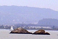
The Sisters are two small rocky islands. You can find them in San Pablo Bay, which is part of the larger San Francisco Bay. They are located about 500 meters (about 1,640 feet) northeast of Point San Pedro in Marin County, California.
Discovering The Sisters
These two islands first appeared on a special map in 1850. This map was a "survey map" of the San Francisco Bay area. A survey map shows the exact shape and location of land and water. It was created by a person named Cadwalader Ringgold.
Early Plans for the Islands
Later, in 1867, something interesting happened. The Sisters, along with another set of islands called The Brothers, were set aside. They were "reserved for military purposes" by order of President Andrew Johnson. This meant the government wanted to use them for things like defense or training.
Why Military Plans Changed
However, the plans to use The Sisters for military purposes did not work out. There were many legal discussions and disagreements, like arguments in a court. Because of these challenges, the idea of using the islands for the military was eventually stopped. So, The Sisters remained natural, undeveloped islands.
 | Sharif Bey |
 | Hale Woodruff |
 | Richmond Barthé |
 | Purvis Young |


