The Brothers (San Francisco Bay) facts for kids

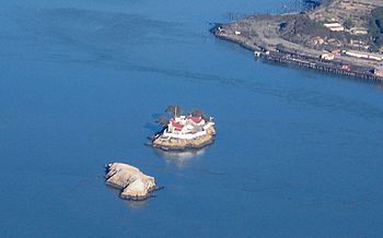
Aerial photo of The Brothers
|
|
| Geography | |
|---|---|
| Coordinates | 37°57′48″N 122°25′59″W / 37.96333°N 122.43306°W |
| Administration | |
| State | California |
| County | Contra Costa County, California |
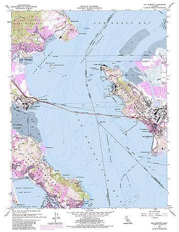
The Brothers are two small islands called East Brother and West Brother. They are found in San Rafael Bay, which is part of San Pablo Bay. These islands are about 300 meters (1,000 feet) west of Point San Pablo in Contra Costa County, California.
Island History

Long ago, in the 1800s, a Mexican map called a Diseño del Rancho de San Pablo showed East Brother Island. On this map, it was named Isla de Pajaros, which means "Bird Island."
Later, in 1850, a survey map of the San Francisco Bay area was made. This map, created by Cadwalader Ringgold, showed both islands. They were clearly labeled as "The Brothers."
Military Plans for the Islands
The Brothers, along with The Sisters, were once set aside for military use. The Sisters are two rocks located about 2 kilometers (2 miles) north of the Marin Islands.
In 1867, President Andrew Johnson ordered that these islands be used for military purposes. However, after many legal battles, these plans were eventually canceled.
East Brother Island Today
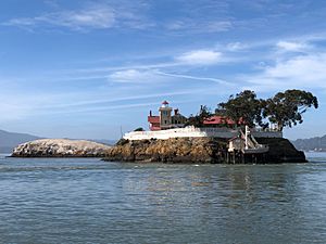
Today, East Brother Island is famous for its East Brother Island Light. This is a historic light house that also includes a beautiful Victorian house. This special house now operates as a bed and breakfast, where people can stay overnight.
 | Delilah Pierce |
 | Gordon Parks |
 | Augusta Savage |
 | Charles Ethan Porter |


