Thunderbird Mountain facts for kids
Quick facts for kids Thunderbird Mountain |
|
|---|---|

Thunderbird Mountain
|
|
| Highest point | |
| Elevation | 8,805 ft (2,684 m) |
| Prominence | 560 ft (170 m) |
| Geography | |
| Parent range | Livingston Range |
| Topo map | USGS Mount Carter, MT |
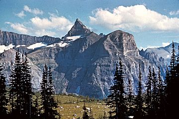
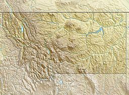
Thunderbird Mountain is a tall peak in Glacier National Park, Montana. It stands about 8,805 feet (2,684 meters) high. This mountain is part of the Livingston Range. It sits right on the Continental Divide. This means that water falling on one side flows to the Atlantic Ocean. Water on the other side flows to the Pacific Ocean. A large ice formation called Thunderbird Glacier is found just northeast of the mountain.
Understanding Thunderbird Mountain's Rocks
Thunderbird Mountain, like many peaks in Glacier National Park, is made of sedimentary rock. This type of rock forms from layers of sand, mud, and tiny bits of plants and animals. These layers build up over millions of years.
How the Rocks Were Formed
The rocks of Thunderbird Mountain were laid down a very long time ago. This happened during the Precambrian and Jurassic periods. Imagine shallow seas covering this area. Over time, sediments settled at the bottom of these seas. These sediments hardened into rock.
The Lewis Overthrust Explained
About 170 million years ago, something huge happened. A massive geological event called the Lewis Overthrust began. This was like a giant push from deep within the Earth. It caused an enormous slab of old Precambrian rocks to slide. This rock slab was about 3 miles (5 km) thick. It was 50 miles (80 km) wide and 160 miles (257 km) long. This ancient rock moved over much younger rock. The younger rock was from the Cretaceous period. This powerful movement lifted the mountains we see today.


