
Thunderbolt, Georgia facts for kids
Quick facts for kids
Thunderbolt, Georgia
|
||
|---|---|---|
|
||

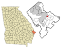
Location in Chatham County and the state of Georgia
|
||
| Country | United States | |
| State | Georgia | |
| County | Chatham | |
| Area | ||
| • Total | 1.56 sq mi (4.04 km2) | |
| • Land | 1.34 sq mi (3.48 km2) | |
| • Water | 0.22 sq mi (0.56 km2) | |
| Elevation | 20 ft (6 m) | |
| Population
(2020)
|
||
| • Total | 2,556 | |
| • Density | 1,903.20/sq mi (734.87/km2) | |
| Time zone | UTC-5 (Eastern (EST)) | |
| • Summer (DST) | UTC-4 (EDT) | |
| ZIP codes |
31404, 31410
|
|
| Area code(s) | 912 | |
| FIPS code | 13-76364 | |
| GNIS feature ID | 0333226 | |

Thunderbolt is a small town in Chatham County, Georgia, United States. It's located about five miles southeast of downtown Savannah. In 2020, about 2,556 people lived there. Thunderbolt is part of the larger Savannah area.
The town sits along the western shore of the Wilmington River. This river is a tidal river and part of the Intracoastal Waterway, which is like a highway for boats along the coast. Thunderbolt is very important for Georgia's shrimping industry. You can see many docks there for shrimping boats. The town is also known for its pretty views and seafood restaurants, which many local visitors enjoy.
Contents
History of Thunderbolt
How Thunderbolt Got Its Name
Thunderbolt had an earlier name: "Warsaw." The government of Georgia officially made it a town called "Warsaw" in 1856. Interestingly, a famous person named Casimir Pulaski died in Thunderbolt. He was born in Warsaw, Poland.
In 1921, the town's name was officially changed to "Thunderbolt." The story goes that the town was named after a lightning strike. This lightning strike supposedly caused a spring to open up in the ground.
Fort Thunderbolt's Role
During the American Civil War, a place called Fort Thunderbolt was built. People also called it the Thunderbolt Battery. Its main job was to protect the city of Savannah. It guarded against Union forces that were trying to advance from Whitemarsh Island.
Geography of Thunderbolt
Where is Thunderbolt Located?
Thunderbolt is located at coordinates 32°1'56" North and 81°3'6" West. This helps us pinpoint its exact spot on a map.
Size and Water Areas
The United States Census Bureau says that Thunderbolt covers a total area of about 1.5 square miles (3.8 square kilometers). Most of this area, about 1.3 square miles (3.3 square kilometers), is land. The remaining 0.2 square miles (0.5 square kilometers) is water.
People of Thunderbolt
Population Changes Over Time
The population of Thunderbolt has changed over the years. Here's how many people have lived there during different census counts:
| Historical population | |||
|---|---|---|---|
| Census | Pop. | %± | |
| 1910 | 543 | — | |
| 1920 | 721 | 32.8% | |
| 1930 | 802 | 11.2% | |
| 1940 | 886 | 10.5% | |
| 1950 | 1,238 | 39.7% | |
| 1960 | 1,925 | 55.5% | |
| 1970 | 2,750 | 42.9% | |
| 1980 | 2,165 | −21.3% | |
| 1990 | 2,786 | 28.7% | |
| 2000 | 2,340 | −16.0% | |
| 2010 | 2,668 | 14.0% | |
| 2020 | 2,556 | −4.2% | |
| U.S. Decennial Census | |||
Who Lives in Thunderbolt?
In 2020, there were 2,556 people living in Thunderbolt. These people made up 1,091 households, and 516 of these were families. The town is home to people from many different backgrounds.
| Race | Num. | Perc. |
|---|---|---|
| White (non-Hispanic) | 1,376 | 53.83% |
| Black or African American (non-Hispanic) | 639 | 25.0% |
| Native American | 1 | 0.04% |
| Asian | 81 | 3.17% |
| Other/Mixed | 115 | 4.5% |
| Hispanic or Latino | 344 | 13.46% |
Images for kids
-

The official seal of Thunderbolt, Georgia.
-
A map showing Thunderbolt's location in Chatham County, Georgia.
See also
 In Spanish: Thunderbolt (Georgia) para niños
