
Tierras Nuevas Poniente facts for kids
Quick facts for kids
Tierras Nuevas Poniente
|
|
|---|---|
|
Barrio
|
|

Secluded beach in Tierras Nuevas Poniente
|
|

Location of Tierras Nuevas Poniente within the municipality of Manatí shown in red
|
|

Tierras Nuevas Poniente
Location in Caribbean
|
|
| Commonwealth | |
| Municipality | |
| Area | |
| • Total | 7.30 sq mi (18.9 km2) |
| • Land | 6.26 sq mi (16.2 km2) |
| • Water | 1.04 sq mi (2.7 km2) |
| Elevation | 10 ft (3 m) |
| Population
(2010)
|
|
| • Total | 3,614 |
| • Density | 577.3/sq mi (222.9/km2) |
| Source: 2010 Census | |
| Time zone | UTC−4 (AST) |
Tierras Nuevas Poniente is a small, countryside area, also known as a barrio, located in the town of Manatí, Puerto Rico. In 2010, about 3,614 people lived there.
| Historical population | |||
|---|---|---|---|
| Census | Pop. | %± | |
| 1900 | 1,534 | — | |
| 1910 | 1,770 | 15.4% | |
| 1920 | 1,715 | −3.1% | |
| 1930 | 2,568 | 49.7% | |
| 1940 | 2,621 | 2.1% | |
| 1950 | 2,435 | −7.1% | |
| 1980 | 2,841 | — | |
| 1990 | 3,299 | 16.1% | |
| 2000 | 4,098 | 24.2% | |
| 2010 | 3,614 | −11.8% | |
| U.S. Decennial Census 1899 (shown as 1900) 1910-1930 1930-1950 1980-2000 2010 |
|||
Contents
History of Tierras Nuevas Poniente
How Puerto Rico Became Part of the U.S.
After the Spanish–American War, Spain gave Puerto Rico to the United States. This happened because of a special agreement called the Treaty of Paris of 1898. Puerto Rico then became a territory of the United States.
Early Population Count
In 1899, the United States government counted everyone living in Puerto Rico. This was part of a big survey called a census. The count showed that 1,534 people lived in Tierras Nuevas Poniente at that time.
Fun Places to Visit
Playa Cueva Las Golondrinas
Tierras Nuevas Poniente is home to a beautiful spot called Playa Cueva Las Golondrinas. This beach is known for its natural beauty. It's a great place to explore the coast.
Gallery
-
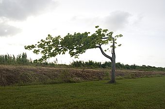
On the road (Calle La Esperanza) heading north towards Esperanza Beach
-
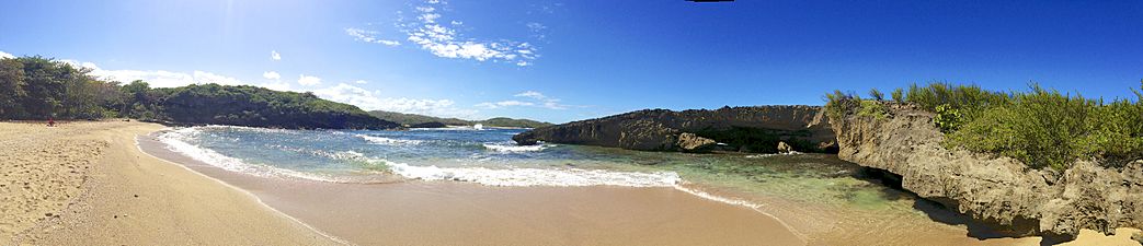
Cueva de las Golondrinas


See also
 In Spanish: Tierras Nuevas Poniente para niños
- List of communities in Puerto Rico
