Tijeras Canyon facts for kids
Tijeras Canyon, also known as Tijeras Pass, is a famous canyon in the middle of New Mexico, a state in the United States. It acts like a natural border, separating the Sandia Mountains to the north from the Manzano Mountains to the south. These two mountain ranges are sometimes seen as parts of one bigger mountain chain.
The lowest parts of the canyon are about 5,600 feet (1,707 meters) to 7,000 feet (2,134 meters) above sea level. Water from the canyon flows west into a large dry riverbed called Tijeras Arroyo. This arroyo goes through Kirtland Air Force Base and past the Albuquerque International Airport before joining the Rio Grande river.
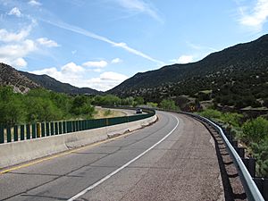
The arroyo starts at an important mountain pass, which is about 7,040 feet (2,146 meters) high. Both this pass and the entire canyon are crossed by Interstate 40. This major highway follows the path of the historic U.S. Route 66. Route 66 used to go through Santa Fe and enter Albuquerque from the north. But in 1937, Governor Arthur Hannett changed the route to go through Tijeras Canyon instead. He did this because he felt some politicians had stopped him from being re-elected.
Contents
The Name of Tijeras Canyon
The word Tijeras means "scissors" in Spanish. People say the canyon got its name because two smaller canyons meet there, like the blades of scissors. Or perhaps it was named for the meeting point of two roads.
The name Tijeras was originally only for the small village of Tijeras where these paths met. The canyon's first name was Cañon de Carnué. However, today, almost everyone calls the entire canyon "Tijeras Canyon."
Early Inhabitants of the Canyon
The first people to live in Tijeras Canyon were the Pueblo people. They built a village called Tijeras Pueblo near where the town of Tijeras is now. This ancient site has been empty for a very long time.
Building a Railroad
In 1901, there was a plan to build a railroad through Tijeras Canyon. This railroad, called the Albuquerque Eastern Railway, would connect to the New Mexico Central at Moriarty. It would also have a branch line going to the coal mines near Hagan.
Some of the ground was prepared for the tracks, and you can still see parts of this work near the western entrance of the canyon. However, no tracks were ever laid in the canyon. The entire project was stopped in 1908.
The Cement Plant
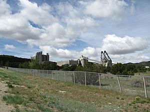
The biggest employer in Tijeras Canyon is a cement factory. This plant opened in the late 1950s. Its buildings and the areas where they dig for materials are very noticeable. They cover a large part of the canyon and the hills southwest of the town of Tijeras.
Developing Route 66
In 1950, the road project in Tijeras Canyon was the largest road building job ever in New Mexico. It was also the first time a four-lane divided highway for U.S. Route 66 was built in the state.
A company called Skousen, Isbell & Johnston Contracting Company won the contract for this project. The work was finished in 1951. This road project stretched from the eastern edge of Albuquerque to about a mile east of Tijeras.
See also
 In Spanish: Cañón de las Tijeras para niños
 | Aurelia Browder |
 | Nannie Helen Burroughs |
 | Michelle Alexander |


