
Timken, Kansas facts for kids
Quick facts for kids
Timken, Kansas
|
|
|---|---|

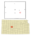
Location within Rush County and Kansas
|
|

|
|
| Country | United States |
| State | Kansas |
| County | Rush |
| Founded | 1880s |
| Incorporated | 1930 |
| Named for | Henry Timken |
| Area | |
| • Total | 0.13 sq mi (0.33 km2) |
| • Land | 0.13 sq mi (0.33 km2) |
| • Water | 0.00 sq mi (0.00 km2) |
| Elevation | 1,959 ft (597 m) |
| Population
(2020)
|
|
| • Total | 38 |
| • Density | 292/sq mi (115/km2) |
| Time zone | UTC-6 (CST) |
| • Summer (DST) | UTC-5 (CDT) |
| ZIP code |
67575
|
| Area code | 785 |
| FIPS code | 20-70625 |
| GNIS ID | 2397024 |
Timken is a small city located in Rush County, Kansas, in the United States. In 2020, a count of the people living there, called a census, showed that 38 people lived in the city.
Contents
History of Timken
How Timken Got Its Name
The city of Timken was named after a man named Henry Timken. He was a person who bought land hoping its value would increase. Henry Timken bought land where he thought the Atchison, Topeka & Santa Fe Railroad would build its tracks.
When he sold the land to the railroad company, one of his conditions was that the town built there would be named after him.
Early Days of the Town
After the town was named, many businesses started to open. A place to cut wood (a lumber mill) was built. There was also a train station (railroad depot), a grocery store, and even a bowling alley.
Many of the first people who settled in Timken were immigrants. They came from countries like Czechoslovakia, Bohemia, and Moravia.
Timken's Post Office
A post office opened in Timken in 1888. This was a place where people could send and receive mail. The post office served the community for many years. It finally closed down in 1996.
Geography of Timken
Timken is a small city in terms of its size. The United States Census Bureau reports that the city covers about 0.15 square miles (0.39 square kilometers). All of this area is land, with no large bodies of water.
People of Timken
Population Changes Over Time
The number of people living in Timken has changed over the years. Here is a look at the population from different census years:
| Historical population | |||
|---|---|---|---|
| Census | Pop. | %± | |
| 1940 | 170 | — | |
| 1950 | 138 | −18.8% | |
| 1960 | 147 | 6.5% | |
| 1970 | 123 | −16.3% | |
| 1980 | 99 | −19.5% | |
| 1990 | 87 | −12.1% | |
| 2000 | 83 | −4.6% | |
| 2010 | 76 | −8.4% | |
| 2020 | 38 | −50.0% | |
| U.S. Decennial Census | |||
Timken in 2010
In 2010, the census showed that 76 people lived in Timken. These people lived in 29 different homes, and 17 of these were families.
The city had about 507 people per square mile (196 people per square kilometer). There were 45 homes available in total.
Most of the people in Timken were White (92.1%). A small number were Asian (1.3%) or from other backgrounds. About 6.6% of the population identified as Hispanic or Latino.
Many homes (34.5%) had children under 18 living there. About half of the homes (48.3%) were married couples. Some homes had a single parent, either a mother (3.4%) or a father (6.9%).
The average age of people in Timken was 39 years old. About 35.5% of residents were under 18. About 19.7% were 65 years old or older. The number of males and females in the city was almost equal, with 50.0% male and 50.0% female.
Education
Children in Timken attend schools in the Otis–Bison USD 403 public school district. This district provides education for students in the area.
Images for kids
-
Location within Rush County and Kansas
-
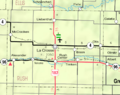
KDOT map of Rush County
See also
 In Spanish: Timken (Kansas) para niños
