Timpas, Colorado facts for kids
Quick facts for kids
Timpas, Colorado
|
|
|---|---|

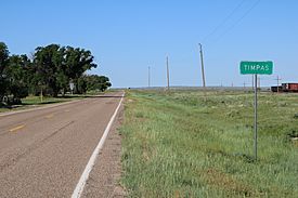
Timpas and U.S. Route 350.
|
|
| Country | |
| State | |
| County | Otero County |
| Elevation | 4,430 ft (1,350 m) |
| Time zone | UTC-7 (MST) |
| • Summer (DST) | UTC-6 (MDT) |
| ZIP code |
81050 (La Junta)
|
| Area code(s) | 719 |
| GNIS feature ID | 0195713 |
Timpas is a small, quiet place in Otero County, Colorado, United States. It is known as an "unincorporated community." This means it does not have its own local government, like a city or town. Instead, it is part of the larger county area. Mail for Timpas is handled by the U.S. Post Office in the nearby town of La Junta. The ZIP Code for Timpas addresses is 81050.
History of Timpas
Timpas once had its very own post office. This post office first opened its doors in 1891. It served the community for many years. However, it eventually closed down in 1970.
The community of Timpas got its name from a nearby natural feature. It was named after Timpas Creek. A creek is a small stream of water.
Where is Timpas?
Timpas is located in the southeastern part of Colorado. Its exact location is 37 degrees, 49 minutes, 5 seconds North latitude and 103 degrees, 46 minutes, 25 seconds West longitude. This is about 1,350 meters (or 4,429 feet) above sea level. It sits in a flat, open area of the state.
 | Charles R. Drew |
 | Benjamin Banneker |
 | Jane C. Wright |
 | Roger Arliner Young |


