Tingoora facts for kids
Quick facts for kids TingooraQueensland |
|||||||||||||||
|---|---|---|---|---|---|---|---|---|---|---|---|---|---|---|---|

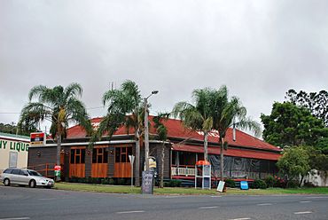
Tingoora Hotel
|
|||||||||||||||
| Population | 272 (2021 census) | ||||||||||||||
| • Density | 13.81/km2 (35.8/sq mi) | ||||||||||||||
| Postcode(s) | 4608 | ||||||||||||||
| Area | 19.7 km2 (7.6 sq mi) | ||||||||||||||
| Time zone | AEST (UTC+10:00) | ||||||||||||||
| Location | |||||||||||||||
| LGA(s) | South Burnett Region | ||||||||||||||
| State electorate(s) | Nanango | ||||||||||||||
| Federal Division(s) | Flynn | ||||||||||||||
|
|||||||||||||||
Tingoora is a small country town in the South Burnett Region of Queensland, Australia. It is known for its friendly community and historical railway connections.
In 2021, about 272 people lived in Tingoora.
Contents
Where is Tingoora?
Tingoora is located on the Bunya Highway. It's about 249 kilometers (155 miles) north-west of Brisbane, the capital city of Queensland.
The Chinchilla–Wondai Road (also known as State Route 82) meets the Bunya Highway in Tingoora. This road forms a "T" shape where it joins the highway.
Tingoora's Past
Tingoora has a rich history, especially linked to the railway.
Early Schools and Railway
A school called Charlestown Provisional School opened around 1894, but it closed that same year.
The Nanango railway line reached Tingoora in December 1904. The town's name comes from the Tingoora railway station. This name is an Indigenous Australian word from the Waka language for the wattle tree.
The Tingoora railway bridge is the longest wooden railway bridge still standing in the South Burnett area. The railway line officially closed in 2010. Today, the restored curved railway bridge is part of the Kingaroy-Kilkivan Rail trail.
First Buildings and New Schools
The Tingoora Hotel, built in 1900, was reportedly the first public building in the town.
Tingoora Provisional School opened its doors on January 20, 1908. It became Tingoora State School on January 1, 1909.
St George's Anglican Church was opened on April 3, 1921. It closed in 1962. The church building was then moved to Proston and is now used as a church hall there.
Another school, Burrandowan State School, opened around May 1923. It closed around 1943.
Schools in Tingoora
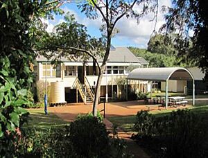
Tingoora State School is a government primary school for students from Prep to Year 6. It is located at 6 Main Street.
In 2018, the school had 33 students. There were 3 teachers and 7 other staff members helping out.
There are no high schools directly in Tingoora. Older students can attend nearby schools. These include Wondai State School (up to Year 10) in Wondai, Murgon State High School (up to Year 12) in Murgon, or Kingaroy State High School (up to Year 12) in Kingaroy.
Fun Things to Do
The Kilkivan to Kingaroy Rail Trail
The Kingaroy-Kilkivan Rail trail is a popular attraction. It follows the path of the old railway line between Kilkivan and Kingaroy. This trail is 88 kilometers (55 miles) long.
It passes through several towns, including Goomeri, Murgon, Wondai, Tingoora, Wooroolin, Memerambi, and Crawford.
The section from Kilkivan to Murgon is unsealed, meaning it's a dirt path. The section from Murgon to Kingaroy is 44 kilometers (27 miles) long and is Queensland's first and longest sealed rail trail. This part is perfect for walkers and cyclists.
The trail crosses Dingo Creek near Wondai and again near Tingoora. Many creeks are crossed using old timber bridges or concrete paths. The most famous bridge is the restored curved wooden railway bridge in Tingoora.


