Tippecanoe, Ohio facts for kids
Quick facts for kids
Tippecanoe, Ohio
|
|
|---|---|

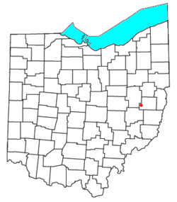
Location of Tippecanoe, Ohio
|
|
| Country | United States |
| State | Ohio |
| County | Harrison |
| Township | Washington |
| Area | |
| • Total | 0.54 sq mi (1.39 km2) |
| • Land | 0.54 sq mi (1.39 km2) |
| • Water | 0.00 sq mi (0.00 km2) |
| Elevation | 1,060 ft (320 m) |
| Population
(2020)
|
|
| • Total | 83 |
| • Density | 154.56/sq mi (59.68/km2) |
| Time zone | UTC-5 (Eastern (EST)) |
| • Summer (DST) | UTC-4 (EDT) |
| ZIP code |
44699
|
| Area code(s) | 740 |
| FIPS code | 39-76890 |
| GNIS feature ID | 2628978 |
Tippecanoe is a small community in Ohio, United States. It's not a city with its own government, but it's recognized as a "census-designated place" (CDP) for counting people. Tippecanoe is located in Washington Township, which is part of Harrison County.
This community sits along State Route 800. It is in the valley of Stillwater Creek. This creek flows north and joins the Tuscarawas River. Tippecanoe used to have its own post office until 2011. In 2020, the population of Tippecanoe was 83 people.
Contents
History of Tippecanoe
Tippecanoe was officially planned and laid out in 1840. This means its streets and lots were mapped out. The community got its name from a famous person, General William Henry Harrison. He was a military hero and later became a U.S. President.
How Tippecanoe Got Its Name
General Harrison had a nickname: "Tippecanoe." This nickname came from his bravery at the Battle of Tippecanoe. This important battle happened on November 7, 1811. The community of Tippecanoe, Ohio, was named to honor him and this event.
A post office was opened in Tippecanoe in 1841. It served the community for many years. However, this post office closed down in 2011.
Geography of Tippecanoe
Tippecanoe is located in the southwestern part of Harrison County. It is about 12 miles south of Uhrichsville. It is also about 5 miles north of Freeport. You can reach these towns by using State Route 800.
Cadiz is the main town, or county seat, of Harrison County. It is about 20 miles east of Tippecanoe. You can get there using local county roads. Tippecanoe is also very close to Clendening Dam. This dam is less than one mile west of the community. It controls the water flow from Clendening Lake.
Land Area
The United States Census Bureau collects information about places. According to their records, Tippecanoe covers a total area of about 1.39 square kilometers. All of this area is land. There is no water area within the official boundaries of the community.
Population of Tippecanoe
Tippecanoe is a small community. The number of people living there is counted regularly. This count helps us understand how communities are growing or changing.
| Historical population | |||
|---|---|---|---|
| Census | Pop. | %± | |
| 2020 | 83 | — | |
| U.S. Decennial Census | |||
The most recent count was in 2020. At that time, the population of Tippecanoe was 83 people. This number shows that it is a very small place.
See also
 In Spanish: Tippecanoe (Ohio) para niños
 | Percy Lavon Julian |
 | Katherine Johnson |
 | George Washington Carver |
 | Annie Easley |

