
Tlaxiaco facts for kids
Quick facts for kids
Tlaxiaco, Oaxaca
|
||
|---|---|---|
| Heroica Ciudad de Tlaxiaco | ||

Monumental clock in Tlaxiaco
|
||
|
||

Tlaxiaco, Oaxaca
Location in Oaxaca

Tlaxiaco, Oaxaca
Location in Mexico
|
||
| Country | ||
| State | Oaxaca | |
| Municipality | Tlaxiaco | |
| Founded | ca. 400 BC | |
| Town status | 1 October 1852 | |
| City status | 7 October 1884 | |
| Area
(municipality)
|
||
| • Total | 343.2 km2 (132.5 sq mi) | |
| Elevation | 2,040 m (6,690 ft) | |
| Population
(2005)
|
||
| • City | 17,450 | |
| • Municip. | 34,587 | |
| Time zone | UTC-6 (Central (US Central)) | |
| • Summer (DST) | UTC-5 (Central) | |
| Postal code |
69800
|
|
| Area code(s) | 953 | |
| Fiestas | 14–21 October | |
| Demonym | Tlaxiaqueño | |
| Website | http://www.tlaxiaco.gob.mx/ | |

Tlaxiaco is a city in the Mexican state of Oaxaca. It is also the name of the area around the city, called a municipality. Tlaxiaco is located in the southern part of the Mixteca Region. About 17,450 people live in the city itself.
The city's full name is Heroica Ciudad de Tlaxiaco, which means "heroic city of Tlaxiaco". This name honors a battle that happened there. The battle was part of the French invasion of Mexico between 1862 and 1867.
The name Tlaxiaco comes from the Nahuatl language. It means "Place where it rains on the ball court." A ball court was a special area for playing a traditional Mesoamerican ballgame. In the Mixtec language, the city's name is Ndijiinu, which means "good view."
In January 2019, Tlaxiaco was in the news. Its newly elected mayor, Alejandro Aparicio, passed away shortly after taking his oath of office.
Contents
About the City of Tlaxiaco
The city of Tlaxiaco is located at 17°16’N, 97°41’W. It sits 2040 meters (about 6,693 feet) above sea level. This is about 100 kilometers (62 miles) northwest of Oaxaca de Juárez, the state capital.
The Tlaxiaco municipality shares borders with several other communities. To the north is Santiago Nundiche. To the south are San Antonio Sinicahua, San Miguel El Grande, San Esteban Atatlahuca, Santa Cruz Nundaco, Santo Tomás Ocotepec, and Putla Villa de Guerrero. To the east, it borders Santa María del Rosario, Santa Catarina Tayata, San Cristobal Amoltepec, and Magdalena Peñasco. To the west, it borders San Juan Mixtepec. The total area of the municipality is 343.2 square kilometers (about 132.5 square miles).

Geography and Climate
Tlaxiaco is in a temperate valley. It is surrounded by two mountains from the Sierra Mixteca range. These are Cerro Negro and Cerro Yucuninu. Cerro Yucuninu is the highest point in the municipality, reaching 2875 meters (about 9,432 feet) above sea level.
Like much of the Mixteca region, the Tlaxiaco valley has many small streams. These streams flow into the Río Balsas river system.
The climate here is temperate and a bit humid. It has a rainy season during the summer months. The average temperature each year is 18°C (64°F). However, in winter, temperatures can drop to 0°C (32°F) or even lower.
Local Wildlife and Nature
Unlike some other parts of the Mixteca region, the Tlaxiaco valley and its mountains still have some conifer forests. These forests are home to various animals. You might find deers, armadillos, rabbits, and other small mammals living there.
Culture and Community
XETLA is a special community radio station based in Tlaxiaco. It is run by the government and focuses on indigenous cultures.
The Santa María Asunción church in the city is famous for its old santos. These are statues of saints from the colonial era.
Famous People from Tlaxiaco
Many talented people come from Tlaxiaco. Some notable individuals include:
- Yalitza Aparicio - a well-known actress and teacher.
- Lila Downs - a famous singer.
- Raúl Gatica Bautista - a writer.
- El Mixteco - a popular blogger.
- Macedonio Jiménez - a former mayor of Nogales, Sonora, Mexico, in 1928.
The Municipality of Tlaxiaco
The city of Tlaxiaco is the main center for the surrounding municipality. This means it is where the local government is located. The municipality includes many smaller communities. Some of these are Agua Zarca, Arboleda, Atayiki, and many more.
In the 2005 Census, the municipality had a population of 34,587 people. Out of these, 9,399 people spoke an indigenous language. The main languages spoken were Mixtecan and Triqui.
Most of the land in the municipality is used for homes and small-scale agriculture. Farming is the main way people in the municipality earn a living.
Images for kids
-
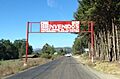
Entrance to the city
See also
 In Spanish: Heroica Ciudad de Tlaxiaco para niños
