Todos los Santos Lake facts for kids
Quick facts for kids Lake Todos los Santos |
|
|---|---|
 |
|
| Coordinates | 41°06′S 72°12′W / 41.100°S 72.200°W |
| Type | monomictic |
| Catchment area | 3,036 km2 (1,172 sq mi) |
| Basin countries | Chile |
| Surface area | 178.5 km2 (68.9 sq mi) |
| Average depth | 192.7 m (632 ft) |
| Max. depth | 337 m (1,106 ft) |
| Water volume | 34.4 km3 (27,900,000 acre⋅ft) |
| Residence time | 4 years |
| Surface elevation | 189 m (620 ft) |
| Islands | one (Isla Margarita) |
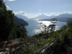
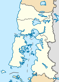
Lake Todos los Santos is a beautiful lake in southern Chile. Its name means "All Saints Lake" in Spanish. You can find it in the Los Lagos Region, inside the Vicente Pérez Rosales National Park. This park protects the lake and its surroundings.
The lake is about 96 km northeast of Puerto Montt. It is also 76 km east of Puerto Varas. Lake Todos los Santos covers an area of 178.5 square kilometers. It is very deep, reaching a maximum of 337 meters. The area around the lake is covered with old Valdivian temperate rain forests. The lake's shape was created by glaciers and volcanoes long ago.
How the Lake Works
The main river that flows into Lake Todos los Santos is the Río Peulla/Río Negro. This river enters near the village of Peulla. Water flows out of the lake through the Petrohué River. On average, 270 cubic meters of water leave the lake every second.
The lake's water level can change by more than 3 meters. These changes affect how much water flows into the Petrohué River. Not far from where it starts, the Petrohué River flows through the amazing Petrohué Waterfalls.
The lake's color can look different depending on the weather. It might appear green, blue, or silver. The greenish color comes from tiny bits of rock. These bits are carried into the lake by water from melting glaciers.
A Look Back in Time
About 20,000 years ago, a huge glacier filled the area where Lake Todos los Santos is now. This glacier started to melt and move away around 10,000 years ago. After the glacier left, the area was a big valley with rivers flowing through it.
The lake itself formed much later. Lava from the Osorno and Calbuco volcanoes flowed into the valley. This lava created a natural dam across the lower part of the valley. The dam trapped the river water, and slowly, the lake began to fill up.
Over time, this lake has had many different names. Local people used to call it Purailla, Pichilauquen, or Quechocavi. In the 1800s, German settlers called it Lake Esmeralda. This name meant "Emerald Lake" because of its green water. However, people later went back to the name given by Jesuit missionaries: Todos los Santos Lake.
Visiting the Lake
Lake Todos los Santos is a popular spot for tourists. You can travel by road and boat between Puerto Montt or Puerto Varas in Chile. You can also go to San Carlos de Bariloche in Argentina, which is on Nahuel Huapi Lake.
There are two main places where boats stop on the lake. Petrohué is at the western end. The village of Peulla is at the eastern end. There is no road that connects these two places.
Steep mountains surround the lake, so there are only small flat areas. Some of the mountains you can see include the Osorno volcano to the west. To the north, you'll find the Puntiagudo. And to the east, there is the Tronador mountain.
See also
 In Spanish: Lago Todos los Santos para niños
 | Claudette Colvin |
 | Myrlie Evers-Williams |
 | Alberta Odell Jones |


