Toll Creagach facts for kids
Quick facts for kids Toll Creagach |
|
|---|---|

Toll Creagach (centre)
|
|
| Highest point | |
| Elevation | 1,054 m (3,458 ft) |
| Prominence | 182 m (597 ft) |
| Listing | Munro, Marilyn |
| Geography | |
| Location | Inverness-shire, Scotland |
| Parent range | Northwest Highlands |
| OS grid | NH194282 |
| Topo map | OS Landranger 25 |
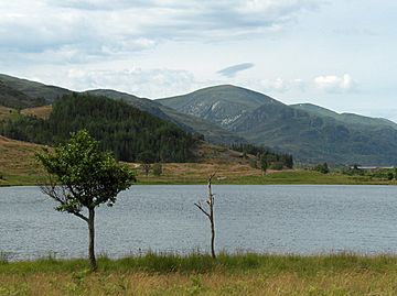
Toll Creagach is a cool mountain in the Northwest Highlands of Scotland. It stands tall at 1,054 meters (about 3,458 feet). This makes it one of Scotland's famous "Munros." It's located in a beautiful part of Scotland, between Glen Affric and Loch Mullardoch.
Contents
What is Toll Creagach?
Toll Creagach is a mountain found in the Northwest Highlands of Scotland. It's known for its rounded, dome-like shape. The mountain has special bowl-shaped hollows on its sides called corries. These were carved out by glaciers long, long ago.
Where is Toll Creagach Located?
This mountain is in Inverness-shire. It sits right between two amazing places: Glen Affric to the south and Loch Mullardoch to the north. The closest village is Cannich, which is to the east.
Climbing Toll Creagach
Many people enjoy hiking up Toll Creagach. It's usually climbed from the Glen Affric side. Hikers often combine it with nearby mountains. This makes for a longer, more exciting adventure.
What is a Munro?
A Munro is a Scottish mountain that is over 3,000 feet (914.4 meters) high. Toll Creagach is one of 282 Munros in Scotland. Climbing all of them is a popular challenge for hikers. It's called "Munro Bagging."
What is a Marilyn?
A Marilyn is a hill or mountain in the British Isles. It has a "prominence" of at least 150 meters (492 feet). Prominence means how much a mountain rises above the land around it. Toll Creagach is also a Marilyn.
 | Stephanie Wilson |
 | Charles Bolden |
 | Ronald McNair |
 | Frederick D. Gregory |

