Tooeys Lake facts for kids
Quick facts for kids Tooeys Lake |
|
|---|---|
| lac Tooeys | |
| Location | Renfrew County, Ontario |
| Coordinates | 45°20′34″N 77°01′35″W / 45.34278°N 77.02639°W |
| Part of | Saint Lawrence River drainage basin |
| Primary outflows | Tooeys Creek |
| Basin countries | Canada |
| Max. length | 490 m (1,610 ft) |
| Max. width | 140 m (460 ft) |
| Surface elevation | 329 m (1,079 ft) |
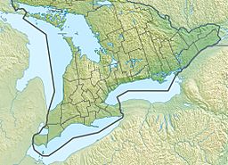
Tooeys Lake (also known as French: lac Tooeys in French) is a lake located in Greater Madawaska, which is part of Renfrew County in Eastern Ontario, Canada. This lake is an important part of the Saint Lawrence River drainage basin. A drainage basin is like a giant funnel where all the rain and snowmelt in an area eventually flows into one main river or lake. Tooeys Lake is also the starting point for Tooeys Creek.
About Tooeys Lake
Tooeys Lake is a relatively small lake. It stretches about 490 meters (1,608 feet) long and is about 140 meters (459 feet) wide. The lake sits at an elevation of 329 meters (1,079 feet) above sea level.
Water Flow
Water flows into Tooeys Lake from three different places. These are called inflows. One inflow comes from the northwest, another from the northeast, and a third from the east. These are small streams that feed the lake.
The main stream that flows out of Tooeys Lake is called Tooeys Creek. This outflow is located at the southeast side of the lake. Near where the creek begins, there is a rest area right next to Ontario Highway 41. This is a convenient spot for travelers to stop and enjoy the view.
The Journey of Tooeys Creek
Tooeys Creek starts its journey from Tooeys Lake. It then flows into Black Donald Creek. From there, the water continues into Black Donald Lake. Next, it joins the Madawaska River. The Madawaska River then flows into the Ottawa River. Finally, the Ottawa River empties into the mighty Saint Lawrence River. This shows how all these waterways are connected, forming a large network that eventually reaches the Atlantic Ocean.


