
Topock, Arizona facts for kids
Quick facts for kids
Topock, Arizona
|
|
|---|---|

Old Trails Bridge built in 1914
|
|

Location in Mohave County, Arizona
|
|

Topock, Arizona
Location in Arizona

Topock, Arizona
Location in the United States
|
|
| State | Arizona |
| County | Mohave |
| Area | |
| • Total | 0.26 sq mi (0.67 km2) |
| • Land | 0.26 sq mi (0.67 km2) |
| • Water | 0.00 sq mi (0.00 km2) |
| Population
(2020)
|
|
| • Total | 2 |
| • Density | 7.69/sq mi (2.97/km2) |
| Time zone | MST |
| ZIP code |
86436
|
| Area code(s) | 928 |
| FIPS code | 04-74750 |
Topock (pronounced Toe-pock) is a small community in Mohave County, Arizona. It is located in the United States. In 2020, only 2 people lived in the main area of Topock. However, the wider area, including nearby Golden Shores, had about 2,104 people in 2010.
Topock is found between Bullhead City and Lake Havasu City. It is also southeast of Needles, California, right on the border between California and Arizona.
This area is famous for boating. It is also home to the Old Trails Arch Bridge. This bridge was once part of the historic Route 66. You might have seen it in movies like The Grapes of Wrath and Easy Rider.
The Topock Marina is a popular spot for boaters. It sits on the Colorado River between Needles and Lake Havasu City. Many boaters stop here to refuel their boats during their trips.
Topock is also where Pacific Gas & Electric (PG&E) has a special station. This station helps move natural gas through a long pipeline. The pipeline goes all the way from Texas to San Francisco. It was finished in 1930.
Contents
Topock's Past: A Railroad and Steamboat Stop
_underpass-1945.jpg)

Topock was first known as Mellen. It was an important stop for both railroads and steamboats. In May 1890, the Atlantic and Pacific Railroad built the Red Rock Bridge here. This was a strong steel bridge that crossed the Colorado River. Earlier bridges had been washed away by the river.
The town was named after Captain "Jack" Mellon. He was a steamboat captain who worked on the Colorado River for 40 years. His name was misspelled as "Mellen" for the town. Mellen even had its own post office from 1903 to 1909.
The PG&E Compressor Station
PG&E started sending natural gas to northern California in 1930. They used what was then the longest pipeline in the world. This pipeline connected gas fields in Texas to California. Along the pipeline, there were "compressor stations." These stations helped push the gas along. Topock, Arizona, was one of these important stations.
In the past, a substance was used at the Topock station to prevent rust in cooling towers. These towers helped prepare the gas for its journey. The water from these towers was then put into the ground near the station.
Since 1996, PG&E has been working to clean up the area. They are making sure the ground and water around the Topock station are safe. They continue to report on their cleanup efforts. This helps protect the Colorado River and Arizona's groundwater.
See also
 In Spanish: Topock (Arizona) para niños
Images for kids
-
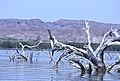
Topock Marsh

