Torquay, Queensland facts for kids
Quick facts for kids TorquayHervey Bay, Queensland |
|||||||||||||||
|---|---|---|---|---|---|---|---|---|---|---|---|---|---|---|---|

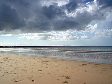
Beach at Torquay in 2006
|
|||||||||||||||
| Population | 6,533 (2021 census) | ||||||||||||||
| • Density | 1,390/km2 (3,600/sq mi) | ||||||||||||||
| Postcode(s) | 4655 | ||||||||||||||
| Elevation | 4 m (13 ft) | ||||||||||||||
| Area | 4.7 km2 (1.8 sq mi) | ||||||||||||||
| Time zone | AEST (UTC+10:00) | ||||||||||||||
| Location |
|
||||||||||||||
| LGA(s) | Fraser Coast Region | ||||||||||||||
| State electorate(s) | Hervey Bay | ||||||||||||||
| Federal Division(s) | Wide Bay | ||||||||||||||
|
|||||||||||||||
|
|||||||||||||||
Torquay (pronounced tor-KEY) is a lovely coastal suburb located in Hervey Bay, Queensland, Australia. It's part of the Fraser Coast Region. In 2021, about 6,533 people called Torquay home.
Contents
Discovering Torquay's Location
Torquay is about 298 kilometers (or 185 miles) north of Brisbane, the capital city of Queensland. It's one of five suburbs in Hervey Bay that sits right by the beach. You'll find mostly homes here, but also some apartment buildings for tourists.
Torquay's Past: A Look at Its History
How Torquay Got Its Name
The name Torquay might sound like the English seaside town of Torquay. However, its true origin is thought to come from the Kabi language. The words dhakki-talbur were shortened to dhakki. This word means "a place of short stones," "a rocky reef," or "a stone axe." The similar sound probably led to the English spelling.
Schools and Railways in Torquay
Torquay Provisional School first opened its doors on January 21, 1901. It later became Torquay State School on January 1, 1909.
The Hervey Bay railway line reached Torquay on December 19, 1913. Torquay railway station served the local area. This railway line closed on June 30, 1993. The old station site has since been turned into housing.
Churches and Community Life
In 1919, a Baptist church was built in Torquay. It was put up by the Maryborough Baptist Church. The church officially opened on Saturday, October 4, 1919. A special train brought over 500 people from Maryborough to celebrate the opening! This church building was later moved and is now a private home in Booral.
All Souls' Anglican Church opened in 1968 but closed around 1988.
Star of the Sea Catholic School welcomed its first students on January 23, 1984.
Who Lives in Torquay?
In 2006, Torquay had a population of 5,693 people. By 2016, this number grew to 6,316 residents. The most recent count in 2021 showed that 6,533 people live in Torquay.
Learning in Torquay: Local Schools
Torquay has two primary schools for children:
- Torquay State School is a government primary school for students from Prep to Year 6. It's located on Tavistock Street. In 2018, the school had 441 students and also offers a special education program.
- Star of the Sea Catholic School is a Catholic primary school for students from Prep to Year 6. You can find it on Hughes Road. In 2018, 349 students attended this school.
There isn't a secondary school right in Torquay. The closest high school is Urangan State High School, which is just next door in Urangan.
Community Places in Torquay
Torquay is home to several community buildings:
- Hervey Bay Uniting Church is located at the corner of Exeter Street and Tavistock Streets.
- The Kingdom Hall of Jehovah's Witnesses can be found at 88 Exeter Street.
 | Jewel Prestage |
 | Ella Baker |
 | Fannie Lou Hamer |


