Trayning, Western Australia facts for kids
Quick facts for kids TrayningWestern Australia |
|
|---|---|

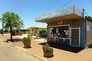
View of Railway Street, Trayning, 2014
|
|
| Established | 1912 |
| Postcode(s) | 6488 |
| Area | [convert: needs a number] |
| Location |
|
| LGA(s) | Shire of Trayning |
| Region | Wheatbelt |
| State electorate(s) | Central Wheatbelt |
| Federal Division(s) | Durack |
Trayning is a small town located in the north-eastern Wheatbelt area of Western Australia. It is about 236 kilometers (147 miles) east of Perth, which is the state's capital city. The town sits on the Nungarin–Wyalkatchem Road. In 2006, Trayning had a population of 122 people.
Contents
History of Trayning
How Trayning Got Its Name
In 1910, plans were made for a new railway line connecting Dowerin to Merredin. Trayning was chosen as a good spot for a railway siding, which is a short track where trains can stop or pass.
Land was set aside in 1910 for a townsite to be called Trayning Siding. However, when the area was officially mapped and named in 1912, it was simply called Trayning.
The town's name comes from Trayning Well. This was an Aboriginal name for a water source nearby. It was on an old road that went from Goomalling to the eastern goldfields. A surveyor first wrote down the name in 1892. It is believed to come from the Aboriginal word During, which means "snake in the grass by the campfire."
Trayning's Railway Connection
Early Wheat Transport System
In 1932, the Wheat Pool of Western Australia announced an important change for Trayning. The town's railway siding would get two grain elevators. These elevators are tall structures used to store and load grain, and each would have its own engine.
Trayning was one of the first five places in Western Australia to use this new system. It helped transport wheat in large amounts on the Western Australian Government Railways. This made Trayning one of the first locations for the Co-operative Bulk Handling (CBH) system. This system helps farmers store and move their grain efficiently.
Railway Line Closure
The railway line that connected Trayning to Merredin was later called a "Tier 3 line." This means it was a less busy part of the wheatbelt railway network. This specific railway line was closed in October 2013.
Life in Trayning Today
Things to Do and See
Trayning is a good starting point for tourists who want to explore the local wildflowers. The area is known for its beautiful blooms, especially in spring.
The town has a primary school for students from Kindergarten to Year 7. This school first opened in 1912 and currently has about 15 students. There is also a 25-meter swimming pool for residents to enjoy.
A popular event in Trayning is the annual Trayning Tractor Pull. This is where powerful tractors compete to pull heavy weights over a short distance.
Farming in the Area
The land around Trayning is used for farming. Farmers in this area grow wheat and other cereal crops. Cereal crops include plants like barley and oats, which are grown for their edible grains.
Trayning is also a receival site for Cooperative Bulk Handling. This means farmers bring their harvested grain to Trayning to be stored and prepared for transport.
 | Frances Mary Albrier |
 | Whitney Young |
 | Muhammad Ali |


