Trentwood, Washington facts for kids
Quick facts for kids
Trentwood, Washington
|
|
|---|---|
|
Locale
|
|

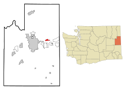
Location of Trentwood, Washington
|
|
| Country | United States |
| State | Washington |
| County | Spokane |
| Area | |
| • Total | 1.8 sq mi (4.6 km2) |
| • Land | 1.8 sq mi (4.6 km2) |
| • Water | 0.0 sq mi (0.0 km2) |
| Elevation | 2,028 ft (618 m) |
| Population
(2000)
|
|
| • Total | 4,388 |
| • Density | 2,482.2/sq mi (958.4/km2) |
| Time zone | UTC-8 (Pacific (PST)) |
| • Summer (DST) | UTC-7 (PDT) |
| FIPS code | 53-72310 |
| GNIS feature ID | 1512737 |
Trentwood was once a small community in Spokane County, Washington, in the United States. It was located east of a place called Irwin, across the Spokane River. In the year 2000, about 4,388 people lived there.
Trentwood used to be known as a "census-designated place" (CDP). This means it was an area that the government counted for population, but it wasn't officially a city or town. In 2003, Trentwood joined with other nearby communities to form the city of Spokane Valley.
Trentwood's Story
Trentwood was first called East Trent. This was because it was located across the Spokane River from a place named Trent (which later became Irwin). East Trent wasn't one big town. Instead, it was a group of smaller communities.
One part was a train station called Steno. It was named after a local court reporter. Another area was Trentwood Orchards, known for its lumber and fruit trees. In 1917, the name Trentwood was chosen for the whole area. This happened after the court reporter passed away and many of the fruit trees were gone.
Where is Trentwood?
Trentwood is located in the state of Washington. Its exact spot is at 47 degrees, 41 minutes, 59 seconds North and 117 degrees, 12 minutes, 39 seconds West.
The area of Trentwood was about 1.8 square miles (4.6 square kilometers). Most of this area was land.
See also
 In Spanish: Trentwood (Washington) para niños
 | Frances Mary Albrier |
 | Whitney Young |
 | Muhammad Ali |

