Trinity Beach, Queensland facts for kids
Quick facts for kids Trinity BeachCairns, Queensland |
|||||||||||||||
|---|---|---|---|---|---|---|---|---|---|---|---|---|---|---|---|
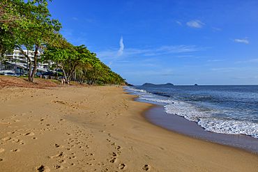
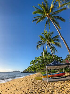
Trinity Beach looking north
|
|||||||||||||||
| Population | 6,594 (2021 census) | ||||||||||||||
| • Density | 767/km2 (1,990/sq mi) | ||||||||||||||
| Postcode(s) | 4879 | ||||||||||||||
| Area | 8.6 km2 (3.3 sq mi) | ||||||||||||||
| Time zone | AEST (UTC+10:00) | ||||||||||||||
| Location |
|
||||||||||||||
| LGA(s) | Cairns Region | ||||||||||||||
| State electorate(s) | Barron River | ||||||||||||||
| Federal Division(s) | Leichhardt | ||||||||||||||
|
|||||||||||||||
Trinity Beach is a lovely coastal area near Cairns in Queensland, Australia. It's a popular place to live and visit, known for its beautiful beach. In 2021, Trinity Beach was home to 6,594 people.
Contents
Exploring Trinity Beach's Location
Trinity Beach is about 20 kilometers (12 miles) north-northwest of the Cairns city centre. It's also just 6.6 kilometers from the nearby town of Smithfield. The beach itself stretches for about a mile along Australia's eastern coast, right next to the Coral Sea. The entire suburb is about 2 kilometers wide.
A Look at Trinity Beach's Past
Trinity Beach is located on the traditional lands of the Djabugay (Tjapukai) Aboriginal people. The name "Trinity Beach" comes from Trinity Bay, which is a large bay nearby.
Trinity Beach During World War II
From 1943 to 1944, Trinity Beach was a very important training spot. Australian and American soldiers practiced special water landings here. This training helped them prepare for battles during World War II.
Growing into a Suburb
Trinity Beach State School, a local primary school, first opened its doors on January 30, 1979. In the 1970s, Trinity Beach started to grow with more houses and buildings. By the mid-1980s, over 2,000 people lived here. On March 22, 1995, Trinity Beach became part of the new City of Cairns.
Weather Events and Development
In 2000, a big storm called Cyclone Steve hit the area. It caused damage to buildings, including the roof of the Trinity Beach Hotel.
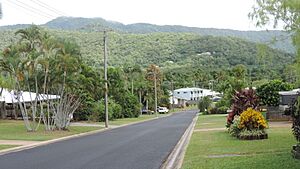
Later, from 2004 to 2008, a large new housing area called Bluewater was planned. This area stretches across both Trinity Beach and Trinity Park. Some parts of this area are in a flood zone. To fix this, a big project was started in 2010 to help prevent flooding.
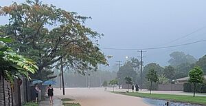
In 2023, Trinity Beach was affected by Cyclone Jasper and the heavy rains that followed. On December 13, when the cyclone hit, the beachfront experienced a storm surge. Days later, on December 17, Trinity Beach had significant flooding. This led to warnings for people to leave their homes in the Bluewater Estate. Major roads were closed, cutting off Trinity Beach from the rest of Cairns. Videos showed many flooded homes. After the floods, the beach was covered in a lot of debris.
Who Lives in Trinity Beach?
The number of people living in Trinity Beach has grown over the years:
- In 2011, there were 4,734 people.
- In 2016, there were 5,488 people.
- In 2021, there were 6,594 people.
Learning in Trinity Beach
Trinity Beach State School is a primary school for students from Prep to Year 6. It's located on Wewak Street (16°47′41″S 145°41′22″E / 16.7948°S 145.6895°E). The school also has a special program for students who need extra support. In 2018, over 1,000 students attended the school.
Trinity Beach does not have its own high school. The closest government high school is Smithfield State High School, which is in the nearby suburb of Smithfield.
Community Life and Facilities
The Trinity Beach Community Hall is a place where people can gather for events. It's located at 51 Trinity Beach Road (16°47′22″S 145°41′39″E / 16.78940°S 145.69424°E). As of April 2024, a brand new community hall is being built by the Cairns Regional Council to serve the community even better.
 | James B. Knighten |
 | Azellia White |
 | Willa Brown |


