Trout Pond facts for kids
Quick facts for kids Trout Pond |
|
|---|---|
| Location | Hardy County, West Virginia |
| Coordinates | 38°57′18″N 78°44′10″W / 38.9551098°N 78.7361293°W |
| Type | Natural lake |
| Basin countries | United States |
| Surface area | 0.5–3.0 acres (0.20–1.21 ha) |
| Average depth | 12 ft (3.7 m) (historical) |
| Max. depth | 36 ft (11 m) (historical) |
| Surface elevation | 1,926 feet (587 m) |
| Islands | None |
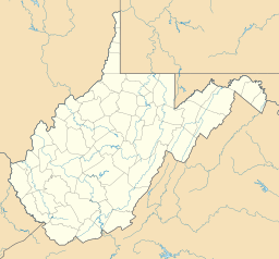
Trout Pond, once known as Old Pond, is a special place in West Virginia, USA. It's the only natural lake in the whole state! You can find this small pond near Wardensville in Hardy County. It's part of the Trout Pond Recreation Area, which is inside the huge George Washington National Forest.
This pond used to be about 2 to 3 acres big. But lately, it seems to be shrinking or even disappearing! This is happening because of changes underground.
How Trout Pond Was Formed
Trout Pond was created by something called a sinkhole. Imagine a giant hole in the ground that fills up with water. That's what happened here! Water from mountain streams on Long Mountain (which is 3,130 feet or 950 meters tall) flowed into this sinkhole.
Much of the land around Trout Pond has layers of limestone rock. Rainwater slowly wears away this limestone. This creates cone-shaped holes in the ground. Many of these sinkholes can become very deep, just like Trout Pond.
For a long time, Trout Pond stayed full of water because of its unique spot. But in July 2002, something changed. Experts thought that the limestone cave under the sinkhole had shifted. This made the water level drop a lot. Within a month, the pond was almost completely dry!
Since then, the pond has filled up again several times. This happens during very rainy weather. But as soon as the rain stops, the water drains away again.
The Rocks Beneath the Pond
Trout Pond and its sinkhole are examples of karst features. Karst is a type of landscape formed when water dissolves soluble rocks like limestone.
Underneath the pond are layers of rock called Tonoloway Limestone and the Helderberg Formation. These are the types of rocks that can be worn away by water, leading to sinkholes and underground caves.
Fun at Trout Pond Recreation Area
The Trout Pond Recreation Area (TPRA) has lots of cool things to do! These facilities were built in the late 1970s.
This campground in the National Forest has a special area for swimming. There are also easy walking trails right by the lake. Kids can have fun at the playground. Plus, there are 50 campsites where families can stay. The area is usually open from early May until the last Monday in October.
Trout Pond got its name because people used to put trout fish into it. This was stopped for a while because too many fishermen were causing the banks to wear away.
 | Sharif Bey |
 | Hale Woodruff |
 | Richmond Barthé |
 | Purvis Young |


