
Truxton, Arizona facts for kids
Quick facts for kids
Truxton, Arizona
|
|
|---|---|
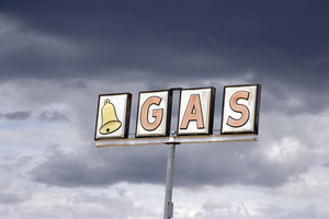
Bell Gas sign, Truxton, Arizona
|
|

Location in Mohave County, Arizona
|
|

Truxton, Arizona
Location in Arizona

Truxton, Arizona
Location in the United States
|
|
| Country | United States |
| State | Arizona |
| County | Mohave |
| Area | |
| • Total | 3.83 sq mi (9.90 km2) |
| • Land | 3.77 sq mi (9.77 km2) |
| • Water | 0.05 sq mi (0.13 km2) |
| Population
(2020)
|
|
| • Total | 104 |
| • Density | 27.56/sq mi (10.64/km2) |
| Time zone | UTC-7 (MST (no DST)) |
| FIPS code | 04-75590 |
Truxton is a small community in Mohave County, Arizona. It is also called a census-designated place (CDP). This means it is an area that the government counts for population, but it is not a formally organized town. In 2020, about 104 people lived there. This was a bit fewer than the 134 people counted in 2010.
Where is Truxton?
Truxton is located in the eastern part of Mohave County. It sits right along Arizona State Route 66. This road used to be part of the famous U.S. Route 66. Truxton is about 41 miles (66 km) northeast of Kingman. Kingman is the main city in Mohave County. It is also about 45 miles (72 km) west of Seligman.
A Look at Truxton's Past
The history of Truxton is tied to the railroads and old highways. In the early 1880s, the Atlantic and Pacific Railroad built tracks through northern Arizona. This railroad later became part of the Santa Fe Railway. Truxton was one of the stops along this important rail line.
The name "Truxton" comes from Truxton Springs. These springs were found by Edward Fitzgerald Beale in 1857-1858. Beale was exploring and building a wagon road through Arizona. The name "Truxtun" was a family name. Beale's mother's maiden name was Emily Truxtun. She was the daughter of a famous person named Thomas Truxtun.
Modern Truxton started to grow in 1951. People began to move there because a large dam, the Bridge Canyon Dam, was planned nearby. They thought the dam would bring a lot of business. Even though the dam was never built, Truxton still grew. This was because of all the cars and trucks traveling on Route 66.
However, things changed in 1978. A new, bigger highway, Interstate 40, opened. This new highway went around Truxton. This meant much less traffic came through the community. As a result, many businesses struggled.
Schools in Truxton
The Valentine Elementary School District serves the Truxton area. The only school in this district is located right in Truxton. It is a school for children from kindergarten through 8th grade. This school has been in Truxton since 1969. Before that, it was in a nearby community called Valentine.
Population Changes
The number of people living in Truxton has changed over time.
- In 2010, the population was 134 people.
- In 2020, the population was 104 people.
| Historical population | |||
|---|---|---|---|
| Census | Pop. | %± | |
| 2010 | 134 | — | |
| 2020 | 104 | −22.4% | |
| U.S. Decennial Census | |||
See also
 In Spanish: Truxton (Arizona) para niños
