Tusas Mountains facts for kids
Quick facts for kids Tusas Mountains |
|
|---|---|
| Highest point | |
| Peak | 11,407 ft (3,477 m) (Grouse Mesa) |
| Dimensions | |
| Length | 67 mi (108 km) north-south |
| Width | 59 mi (95 km) east-west |
| Area | 2,709 sq mi (7,020 km2) |
| Geography | |
| Country | United States |
| State | New Mexico |
| Range coordinates | 36°28′47″N 106°15′06″W / 36.47972°N 106.25167°W |
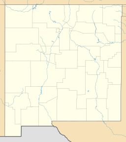
The Tusas Mountains are a mountain range found in northern New Mexico. A small part of them even reaches into southern Colorado. These mountains are thought to be the southeasternmost section of the larger San Juan Mountains.
The highest point in the Tusas Mountains is Grouse Mesa, which stands at 11,407 feet (3,477 m) tall. You can find these mountains west of Taos and northwest of Santa Fe. The Tusas Mountains are a wide area with flat-topped hills called mesas and gently sloping mountains. Some parts have deep canyons carved into them.
Contents
Exploring the Geography of the Tusas Mountains
The Tusas Mountains have different landscapes depending on whether you are in the east or the west.
Eastern Tusas Mountains: Forests and Rivers
The eastern side of the Tusas Mountains is mostly located within the Carson National Forest. To the east, it borders the Taos Plateau volcanic field and the Rio Grande del Norte National Monument. This area is where several important rivers begin.
The Rio San Antonio starts here. This river flows into the Conejos River, which then joins the mighty Rio Grande in Colorado. Further south, the Rio Tusas and Rio Vallecito also begin in these mountains. They combine to form the Rio Ojo Caliente, which is a branch of the Rio Chama. The Rio Chama also flows into the Rio Grande. You can also find many volcanic features along the eastern edge, like San Antonio Mountain.
Western Tusas Mountains: Rugged Peaks and Lakes
Much of the western part of the Tusas Mountains is also known as the Brazos Mountains. This area is mostly private land. The ground here is made of harder rocks like granite. This makes the western side more rugged and rocky than the eastern side.
Here, you can see impressive features like the Brazos Cliffs. There are also several small mountain lakes, such as Hidden Lake and Sugar Loaf Lake. The main rivers draining this side are the Rio Chama and its branch, the Rio Brazos.
History of the Tusas Mountains
The Tusas Mountains have a brief history of mining and a change in how they are named.
Mining for Gold and Silver
In 1881, people discovered gold and silver in the Tusas Mountains. However, the metals found were not of very high quality. Because of this, there was never a lot of mining activity in the area.
How the Mountains Got Their Name
For a long time, the Brazos Mountains were considered a separate mountain range. But in 1986, the United States Board on Geographic Names made a change. They decided that the Brazos Mountains are actually part of the Tusas Mountains. Even though this change happened, many local people still use the old name, Brazos Mountains.
Highest Peaks in the Tusas Mountains
These are the tallest peaks you can find in the Tusas Mountains:
| Rank | Name | Elevation | Prominence | Coordinates |
|---|---|---|---|---|
| 1 | Grouse Mesa | 11,407 ft (3,476 m) |
1,365 ft (416 m) |
36°49′53″N 106°24′27″W / 36.83139°N 106.40750°W |
| 2 | Brazos Peak | 11,286 ft (3,440 m) |
498 ft (151 m) |
36°48′31″N 106°22′56″W / 36.80861°N 106.38222°W |
| 3 | Unnamed peak | 11,060 ft (3,371 m) |
840 ft (256 m) |
|
| 4 | Unnamed peak | 10,977 ft (3,345 m) |
357 ft (109 m) |
|
| 5 | Brazos Ridge | 10,745 ft (3,275 m) |
580 ft (177 m) |
36°55′32″N 106°21′27″W / 36.92556°N 106.35750°W |
 | Precious Adams |
 | Lauren Anderson |
 | Janet Collins |


