Rio San Antonio (Colorado–New Mexico) facts for kids
Quick facts for kids Rio San Antonio |
|
|---|---|

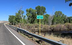
At Highway 142 east of Manassa
|
|
| Country | United States |
| States | Colorado, New Mexico |
| Physical characteristics | |
| Main source | Tusas Mountains Carson National Forest, New Mexico 36°50′56″N 106°18′15″W / 36.84889°N 106.30417°W |
| River mouth | Conejos River near Manassa, Colorado 37°11′14″N 105°53′54″W / 37.18722°N 105.89833°W |
| Basin features | |
| Basin size | 348 sq mi (900 km2) |
The Rio San Antonio is a cool river that flows through northern New Mexico and southern Colorado. It's like a smaller stream that feeds into the Conejos River. From there, its water eventually joins the much larger Rio Grande river system.
People use the river's water a lot for irrigation, especially in the lower parts of the San Luis Valley. This helps farmers grow crops in the dry land.
Where Does the Rio San Antonio Start?
The Rio San Antonio begins its journey in the Tusas Mountains. This area is on the western edge of the Carson National Forest in Rio Arriba County, New Mexico.
From its start, the river flows east through a deep, narrow canyon. Along the way, it gets more water from a stream called Rio Nutritas, which joins it from the south. The river keeps flowing east towards San Antonio Mountain.
How Does the River Flow?
Before reaching San Antonio Mountain, the river changes direction and turns north. It then enters a rocky area known as the Taos Plateau volcanic field. This area is on the edge of the San Luis Valley.
The river crosses into Conejos County, Colorado near a place called Ortiz. Here, another river, the Rio de los Pinos, joins it from the west. The Rio San Antonio then makes a sharp turn east near Antonito. It continues flowing northeast through farmlands. Finally, it empties into the Conejos River at the Sego Springs Wildlife Area, which is a few miles east of Manassa.
What is the Rio San Antonio Wilderness?
The Rio San Antonio Wilderness is a special protected area. The U.S. Congress created it in 2019. It covers about 8,120 acres along the river. The U.S. Bureau of Land Management takes care of this area. It is part of the larger Rio Grande del Norte National Monument.
This wilderness area mainly protects a 100-foot deep gorge along the Rio San Antonio. It also protects the flat plains around it. The elevation here is about 8,400 feet (2560 meters) above sea level. It's a place where nature is left wild and untouched.
 | Laphonza Butler |
 | Daisy Bates |
 | Elizabeth Piper Ensley |

