Conejos River facts for kids
Quick facts for kids Conejos River |
|
|---|---|

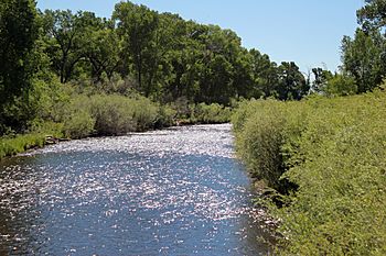
The river north of Antonito, Colorado.
|
|
|
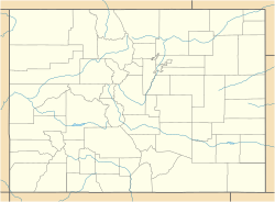
Location of the mouth of the Conejos River in Colorado
|
|
| Country | United States |
| State | Colorado |
| County | Conejos |
| Physical characteristics | |
| Main source | San Juan Mountains 37°16′34″N 106°37′27″W / 37.27611°N 106.62417°W |
| River mouth | Rio Grande San Luis Valley 37°18′14″N 105°44′9″W / 37.30389°N 105.73583°W |
| Length | 92.5 mi (148.9 km) |
| Basin features | |
| Basin size | 887 sq mi (2,300 km2) |
The Conejos River is a river in south-central Colorado, United States. It flows for about 92.5 miles (149 km). This river is a branch, or tributary, of the larger Rio Grande.
The Conejos River helps drain a beautiful area. This area is found in the eastern part of the San Juan Mountains. These mountains are located west of the wide, flat area known as the San Luis Valley.
Contents
River's Journey and Features
The Conejos River starts from melting snow. This happens high up in the San Juan Mountains. Its source is near the continental divide, which is like a big ridge that separates water flowing to different oceans.
Where the River Begins
The river begins west of Conejos Peak. This is in the western part of Conejos County. It's about 15 miles (24 km) northeast of Pagosa Springs.
River's Path
First, the river flows northeast for a short distance. It then goes through Platoro Reservoir. After that, it turns southeast. It flows through the Rio Grande National Forest.
The river then heads east. It follows close to the border of New Mexico. Along this part, it carves out a beautiful canyon.
Entering the San Luis Valley
The Conejos River enters the southwestern part of the San Luis Valley. This happens near the town of Conejos. Finally, it joins the Rio Grande. This meeting point is about 15 miles (24 km) southeast of Alamosa.
Platoro Reservoir
The river is held back at Platoro Reservoir. This reservoir is important for two main reasons. It helps control floods, stopping too much water from overflowing. It also manages water for irrigation. This means it supplies water to farms in the San Luis Valley. The U.S. Bureau of Reclamation manages this project.
River Characteristics
For much of its journey, the Conejos River is wide but not very deep. However, in some areas, the river drops steeply. One such place is Pinnacle Canyon. This spot is very popular for whitewater rafting, where people ride rafts down the fast-moving water.
History of the Area
The land around the Conejos River has a long history. For many years, during the time of New Spain (when Spain ruled this area), new settlements were not allowed near the river.
Early Settlements
In the 1830s, the government of Mexico began giving land to families. These families wanted to settle along the river. One of the first groups of about 50 families tried to settle in 1833. This was part of the Guadalupe Grant. However, these early attempts faced difficulties and were not successful at first.
First Lasting Settlements
The first lasting settlement by new families on the river was started in 1851. This was done by José Jacques. Later, in 1854, the town of Conejos was founded. It was established by Lafayette Head, who later became an important leader in Colorado.
See also
 In Spanish: Río Conejos para niños
 | Janet Taylor Pickett |
 | Synthia Saint James |
 | Howardena Pindell |
 | Faith Ringgold |


