Tusten, New York facts for kids
Quick facts for kids
Tusten, New York
|
|
|---|---|

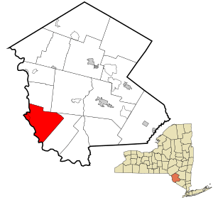
Location of Tusten in Sullivan County, New York
|
|
| Country | United States |
| State | New York |
| County | Sullivan |
| Area | |
| • Total | 48.78 sq mi (126.35 km2) |
| • Land | 47.20 sq mi (122.26 km2) |
| • Water | 1.58 sq mi (4.09 km2) |
| Elevation | 1,115 ft (340 m) |
| Population
(2020)
|
|
| • Total | 1,405 |
| Time zone | UTC-5 (Eastern (EST)) |
| • Summer (DST) | UTC-4 (EDT) |
| FIPS code | 36-75759 |
| GNIS feature ID | 0979565 |
Tusten is a small town located in Sullivan County, in the state of New York, United States. In 2020, about 1,405 people lived there.
The town gets its name from Dr. Benjamin Tusten. He was a brave military leader who died during the Battle of Minisink because he refused to leave his troops. Tusten is found in the southwestern part of Sullivan County.
Contents
History of Tusten
Tusten was created in 1853. Before that, it was part of two other towns: Mamakating and Lumberland.
The very first settler in the area was Benjamin Homans. He made his home near a place called Narrowsburg.
Tusten is also home to some important historical spots. These include the Ten Mile River Baptist Church and the Tusten Stone Arch Bridge. Both of these places are listed on the National Register of Historic Places, which means they are important to the country's history. You can also find the historic Fort Delaware in Tusten. There are special markers around town that tell you about the local history.
Geography and Nature
Tusten is located right next to the Delaware River. This river forms the western border of the town, separating New York from Pennsylvania.
The town covers a total area of about 48.8 square miles (126.35 square kilometers). Most of this area, about 47.3 square miles (122.26 square kilometers), is land. The rest, about 1.5 square miles (4.09 square kilometers), is water.
Population Changes
The number of people living in Tusten has changed over the years. Here's a look at the population from different census counts:
| Historical population | |||
|---|---|---|---|
| Census | Pop. | %± | |
| 1860 | 871 | — | |
| 1870 | 1,028 | 18.0% | |
| 1880 | 1,050 | 2.1% | |
| 1890 | 1,004 | −4.4% | |
| 1900 | 890 | −11.4% | |
| 1910 | 878 | −1.3% | |
| 1920 | 881 | 0.3% | |
| 1930 | 914 | 3.7% | |
| 1940 | 950 | 3.9% | |
| 1950 | 1,042 | 9.7% | |
| 1960 | 1,087 | 4.3% | |
| 1970 | 1,224 | 12.6% | |
| 1980 | 1,424 | 16.3% | |
| 1990 | 1,271 | −10.7% | |
| 2000 | 1,415 | 11.3% | |
| 2010 | 1,515 | 7.1% | |
| 2020 | 1,405 | −7.3% | |
| U.S. Decennial Census | |||
In the year 2000, there were 1,415 people living in Tusten. These people lived in 583 households. About 26% of these households had children under 18 living there. The average age of people in Tusten was 44 years old.
Food and Restaurants
Inside the town of Tusten, you'll find a small community called Narrowsburg. It's right by the river. Narrowsburg is famous locally for its pizza! People even call it "The Pizza Capital of the Upper Delaware River" because it has two pizzerias.
But there's more than just pizza. Narrowsburg also has:
- A Chinese restaurant
- A seasonal ice cream shop where you can drive up
- A BBQ and brewery spot
- Two coffee shops
- A cozy cafe
- A wine bar that serves flatbreads and paninis
- A French-Alsatian bistro
- A restaurant with modern American food
Places in Tusten
Here are some of the different communities and locations you can find within the Town of Tusten:
- Narrowsburg – This is a small community by the Delaware River. It used to be called Homans Eddy.
- Beaver Brook Corners (or Beaver Brook) – You can find this community in the eastern part of the town.
- Feagles Lake – This is a small lake located east of Narrowsburg.
- Hunts Corners – Another community east of Narrowsburg, found on Route 52.
- Lava – This community is also east of Narrowsburg, along Route 52.
- Neweiden – A community southeast of Narrowsburg, near the Ten Mile River. It was once known as Swamp Mills.
- Smith Switch – This spot is in the northwestern part of the town, by the Delaware River and on Route 97.
- Ten Mile River – This is a small river. It's also where a large summer camp for the Boy Scouts of America is located, close to Neweiden.
- Tusten – This is the main community of Tusten, located in the southwestern part of the town on Route 97.
Famous People from Tusten
Some notable people who have connections to Tusten include:
- Benjamin Woodward – A politician.
- Gustavus Adolphus Neumann – A newspaper editor.
See also
 In Spanish: Tusten para niños
 | Kyle Baker |
 | Joseph Yoakum |
 | Laura Wheeler Waring |
 | Henry Ossawa Tanner |

