Twin Butte facts for kids
Quick facts for kids
Twin Butte
|
|
|---|---|

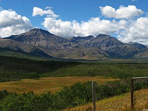
Mount Dungarvan & Cloudy Ridge to the west of Twin Butte.
|
|
| Country | Canada |
| Province | Alberta |
| Region | Southern Alberta |
| Census division | 3 |
| Municipal district | Municipal District of Pincher Creek No. 9 |
| Government | |
| • Type | Unincorporated |
| Area
(2021)
|
|
| • Land | 0.17 km2 (0.07 sq mi) |
| Population
(2021)
|
|
| • Total | 10 |
| • Density | 59.9/km2 (155/sq mi) |
| Time zone | UTC−07:00 (MST) |
| • Summer (DST) | UTC−06:00 (MDT) |
| Area code(s) | 403, 587, 825 |
Twin Butte is a small community called a hamlet in Southern Alberta, Canada. It is part of the Municipal District of Pincher Creek No. 9. You can find it on Highway 6, about 88 kilometers (55 miles) southwest of Lethbridge.
Twin Butte is known as a small ranching community. It is located in the beautiful foothills of Southwest Alberta. The community has a general store, a post office, a restaurant, and a community hall. These are all located along Highway 6.
Contents
What is the History of Twin Butte?
Between 1885 and 1915, many ranching families moved to this area. About 43 families made their homes here. The community got its name from Tillie Mitchell, an early pioneer. She named it in the early 1900s.
The name "Twin Butte" comes from two small hills. These hills look similar in shape and size. They overlook Yarrow Creek to the north of Mitchell's property. Many travelers passing through the area could easily see these hills.
How Did the Post Office Start?
The first post office in the area was the Yarrow Post Office. It opened on April 1, 1895. Bob Christie was the first Postmaster. This post office closed in 1911.
The Twin Butte Post Office opened later, on June 1, 1905. Ed Mitchell Sr. was its first Postmaster. This post office is still open today. It operates out of the Twin Butte General Store. It is a popular stop for people traveling along The Cowboy Trail (Highway 6). This trail runs between the town of Pincher Creek and Waterton Lakes National Park.
Education in Twin Butte
In 1904, Ernest Hillier gave land to build a schoolhouse. This land was about 1 mile east of Twin Butte. The Twin Butte School District No. 988 was then created. Classes first started on September 1, 1904.
The schoolhouse was located on the Southwest Quarter of Section 3, Township 4, Range 29, West of the 4th meridian. The school was used until June 1958. At that time, schools in the area were combined. About 254 students attended the Twin Butte school over the years. Today, children from the area take a bus to Pincher Creek for school.
How Many People Live in Twin Butte?
In 2021, the population of Twin Butte was 10 people. These 10 people lived in 8 of the 9 homes available. This number was the same as its population in 2016.
The land area of Twin Butte is very small, only 0.17 square kilometers (0.066 square miles). This means that in 2021, there were about 59.9 people living per square kilometer.
 | William L. Dawson |
 | W. E. B. Du Bois |
 | Harry Belafonte |


