Tyrone, Oklahoma facts for kids
Quick facts for kids
Tyrone, Oklahoma
|
|
|---|---|

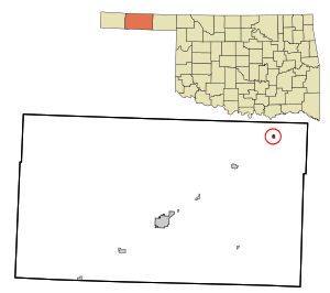
Location in Texas County and state of Oklahoma.
|
|
| Country | United States |
| State | Oklahoma |
| County | Texas |
| Area | |
| • Total | 0.42 sq mi (1.09 km2) |
| • Land | 0.42 sq mi (1.09 km2) |
| • Water | 0.00 sq mi (0.00 km2) |
| Elevation | 2,920 ft (890 m) |
| Population
(2020)
|
|
| • Total | 729 |
| • Density | 1,727.49/sq mi (666.58/km2) |
| Time zone | UTC-6 (Central (CST)) |
| • Summer (DST) | UTC-5 (CDT) |
| ZIP code |
73951
|
| Area code(s) | 580 |
| FIPS code | 40-75750 |
| GNIS feature ID | 1099138 |
Tyrone is a small town located in the northeastern part of Texas County, Oklahoma, in the United States. In 2020, about 729 people lived there.
Contents
Discovering Tyrone's Past
Tyrone got its name from a railway vice president. He named it after Tyrone, Pennsylvania, where his mother lived. The railroad was very important for the town's early days.
How the Railroad Shaped Tyrone
Towns along the railway in Texas County were often built about 10 miles apart. This distance was important for railroad worker camps. It also helped locomotives get water when they needed it.
Shades Well: A Historic Cattle Trail
Nearby, about three miles northeast, was a place called Shades Well. In the late 1800s, this was a major starting point for cattle drives. Cowboys would gather their cattle here before heading out. For a time, Shades Well was even busier than Dodge City. Later, the cattle trail moved, and Shades Well was no longer used.
Tyrone's Location and Size
Tyrone is located at 36°57′16″N 101°04′03″W / 36.954510°N 101.067419°W. It is a small town in terms of land area.
According to the United States Census Bureau, Tyrone covers about 0.4 square miles (1.0 square kilometer). All of this area is land.
Who Lives in Tyrone?
The population of Tyrone has changed over the years. In 2020, there were 729 residents.
Population Changes Over Time
Here's how the number of people living in Tyrone has changed:
| Historical population | |||
|---|---|---|---|
| Census | Pop. | %± | |
| 1930 | 482 | — | |
| 1940 | 257 | −46.7% | |
| 1950 | 261 | 1.6% | |
| 1960 | 456 | 74.7% | |
| 1970 | 588 | 28.9% | |
| 1980 | 928 | 57.8% | |
| 1990 | 880 | −5.2% | |
| 2000 | 880 | 0.0% | |
| 2010 | 762 | −13.4% | |
| 2020 | 729 | −4.3% | |
| U.S. Decennial Census | |||
A Look at Tyrone's Community
In 2000, there were 880 people living in Tyrone. About 40.7% of homes had children under 18. Many families were married couples living together.
The town's population included people of different backgrounds. About 23.52% of the population was of Hispanic or Latino heritage. The median age in Tyrone was 31 years old.
Getting Around Tyrone
Tyrone is connected to other places by roads and railways.
Roads and Highways
The town is located on U.S. Route 54. This highway connects Tyrone to Hooker to the southwest. It also leads to Liberal, Kansas to the northeast.
Air Travel Options
For those who need to fly, the closest airport is Liberal Mid-America Regional Airport. This airport is in Kansas, about 11 miles northeast of Tyrone.
Railroad Services
The Union Pacific Railroad provides freight train services to Tyrone. This helps businesses move goods in and out of the town.
See also
 In Spanish: Tyrone (Oklahoma) para niños
 | Jewel Prestage |
 | Ella Baker |
 | Fannie Lou Hamer |

