
Uinta Highline Trail facts for kids
Quick facts for kids Uinta Highline Trail |
|
|---|---|

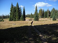
The Uinta Highline Trail in Painter Basin
|
|
| Length | 104 mi (167 km) |
| Location | Uinta Mountains, Utah, USA |
| Trailheads | McKee Draw, U.S. Route 191 Hayden Pass, Utah Route 150 |
| Use | backpacking, hiking, horseback riding, trail running |
| Elevation change | 16,700 ft (5,090 m) |
| Highest point | Anderson Pass, 12,700 ft (3,871 m) |
| Lowest point | McKee Draw (eastern terminus), 8,240 ft (2,512 m) |
| Difficulty | Moderate to strenuous |
| Months | July to September |
| Sights | Kings Peak (highest peak in Utah), High Uintas Wilderness |
| Hazards | Snowmelt and icy slopes early in the season, severe weather, altitude |
The Uinta Highline Trail is an amazing trail in the Uinta Mountains of Utah. It stretches for about 104 miles (167 km) from one side of the mountains to the other. As you hike, you'll see huge open areas formed by ancient glaciers. These areas are filled with hundreds of sparkling lakes.
Contents
Exploring the Uinta Highline Trail
The Uinta Highline Trail is about 104 miles (167 km) long. It follows the highest parts of the Uinta Mountains, going from east to west. The trail starts in the east at McKee Draw, near U.S. Route 191. It ends in the west at Hayden Pass, close to Mirror Lake on Utah Route 150.
Along the way, the trail crosses eight mountain passes that are higher than 11,200 feet (3,414 m). It also goes over many smaller hills and ridges. Between these high points, the trail drops into wide, open valleys carved by glaciers long ago.
The highest point on the trail is Anderson Pass, which is 12,700 feet (3,871 m) high. Kings Peak, the tallest mountain in Utah at 13,528 feet (4,123 m), is very close to Anderson Pass.
What You'll See on the Trail
The Uinta Highline Trail takes you through many different landscapes. You'll walk through:
- Forests
- Open meadows high in the mountains
- Rocky areas and snow fields
- Areas with no trees, offering wide-open views
More than half of the trail is in open, treeless areas. This means you get amazing, expansive views for much of your journey!
Most of the trail, about 96 miles (154 km), is in the Ashley National Forest. The last 8 miles (13 km) are in the Wasatch-Cache National Forest. A big part of the trail is in the High Uintas Wilderness. In this special area, you can only travel by walking or on horseback.
Hiking the Trail
You can hike the Uinta Highline Trail in either direction. However, most people who hike the whole 104 miles (167 km) trail go from east to west.
Starting Your Adventure
The trail usually starts at the Highline Trailhead in McKee Draw. This spot has a restroom and a parking area. The first 25 miles (40 km) of the trail go through forests and meadows. Water can be hard to find in this section, especially later in the summer. After crossing Little Brush Creek, the next water source might be over 20 miles (32 km) away near Leidy Peak. You can find Hacking Lake a short walk off the main trail there.

As you continue west from Leidy Peak, the trail crosses long stretches of open, treeless areas. You'll also go over rocky passes and through some forests. There are many lakes and streams along this part of the trail, which are good for finding water.
Finishing Your Hike
The trail ends at the Highline Trailhead at Hayden Pass. This is on the Mirror Lake Scenic Byway (Utah Route 150). This trailhead also has a restroom and parking. It can get very busy, especially on summer weekends. You might need a day pass to park here, or an annual America the Beautiful Pass.
Other Starting Points
The Uinta Highline Trail also connects to two other trailheads. These are located many miles from paved roads and are reached by gravel roads.
- The Leidy Peak trailhead is at mile 24.
- The Chepeta Lake trailhead is at mile 38.
Starting at one of these trailheads makes the hike shorter. For example, starting at Chepeta Lake shortens the trip to Hayden Pass to about 66 miles (106 km).
You don't need a special permit to hike the Uinta Highline Trail.
Trail Conditions
The Uinta Highline Trail feels very wild and remote. In some places, the path isn't clear. It might just be a route marked by occasional rock piles (called cairns), posts, or signs. This is perfect for hikers who love quiet places and are good at finding their way.
Gallery
-
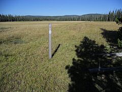
The trail through Big Park.
-
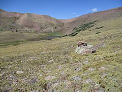
Cairns mark the path to Gabbro Pass.
-
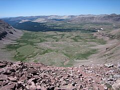
View from Anderson Pass, the high point of the trail.
-
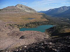
View from the trail at Dead Horse Pass.
-
The trail through Fall Creek Basin.


