Unity Pond facts for kids
Quick facts for kids Unity Pond |
|
|---|---|
 |
|
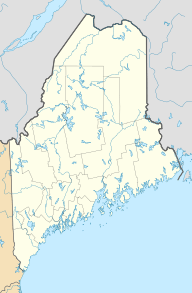
| Location | Waldo County, Maine |
| Coordinates | 44°38′38″N 69°20′2″W / 44.64389°N 69.33389°W |
| Primary outflows | Twenty-Five Mile Stream |
| Catchment area | 32.7 sq mi (85 km2) |
| Basin countries | United States |
| Max. length | 4.1 mi (6.6 km) |
| Max. width | 1.9 mi (3.1 km) |
| Surface area | 2,523 acres (1,021 ha; 3.942 sq mi) |
| Average depth | 22 ft (6.7 m) |
| Max. depth | 41 ft (12 m) |
| Surface elevation | 171 ft (52 m) |
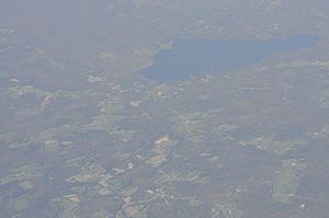
Unity Pond, also known as Lake Winnecook, is the biggest lake in Waldo County, Maine. It's located in the towns of Unity, Burnham, and Troy.
Water flows into the lake from Meadow Brook, Bithers Brook, and Carlton Stream. The water then flows out through Twenty-Five Mile Stream. This stream goes through a wetland area and eventually joins the Sebasticook River.
Many homes are built around the lake, with about half of them being used only during certain seasons. People enjoy Unity Pond for fun activities like boating, fishing, camping, and swimming. There are also two public beaches: Kanokolus Beach and Burnham Town Beach.
Contents
History of Unity Pond
People from Europe first settled around Unity Pond in 1785. In the early 1800s, sawmills were built along the streams that flow into the lake. These sawmills used wood from the nearby forests.
Changes in the Land
By 1830, many trees had been cut down, a process called deforestation. Because of this, most of the sawmills closed. But cutting down trees also made it possible to start farms in the area. Farming continued around the lake for a long time, even into the 1900s.
From the 1920s to the 1950s, factories called canneries opened in the area. They would preserve food, often from local farms.
Farming and Recreation
Around the 1940s, a type of farming where people grow just enough food for themselves, called subsistence agriculture, became less common. Instead, people started raising chickens and dairy cows. At the same time, more and more seasonal camps were built along the lake's edge for people to visit during holidays.
Water Quality in Unity Pond
Unity Pond has faced some challenges with its water quality. Historically, water running off from farms and waste from a canning factory caused problems. This led to something called eutrophication.
Understanding Eutrophication
Eutrophication happens when too many nutrients, like phosphorus, get into the water. This can cause too much algae to grow, leading to "algal blooms" in the summer. These blooms can make the water cloudy and affect the lake's health. Because of this, Unity Pond is on a special state list for areas needing help with water pollution from many different sources.
The Land Around the Lake
The land around Unity Pond is made up of different areas. About 16% of it has buildings or development, while most of it (about 72%) is undeveloped, mainly covered by forests. The rest (about 12%) is the lake's surface water itself.
Fish in the Lake
Unity Pond is home to 20 different kinds of fish. Twelve of these fish species are native, meaning they have always lived there. The lake is also stocked with trout and alewife to help with fishing.
 | Delilah Pierce |
 | Gordon Parks |
 | Augusta Savage |
 | Charles Ethan Porter |


