Usa, Ōita facts for kids
Quick facts for kids
Usa
宇佐市
|
|||||||||||
|---|---|---|---|---|---|---|---|---|---|---|---|
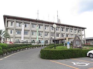
Usa City Hall
|
|||||||||||
|
|||||||||||
 |
|||||||||||
| Country | Japan | ||||||||||
| Region | Kyushu | ||||||||||
| Prefecture | Ōita | ||||||||||
| Area | |||||||||||
| • Total | 439.05 km2 (169.52 sq mi) | ||||||||||
| Population
(November 30, 2023)
|
|||||||||||
| • Total | 52,808 | ||||||||||
| • Density | 120.2779/km2 (311.518/sq mi) | ||||||||||
| Time zone | UTC+9 (Japan Standard Time) | ||||||||||
| Phone number | 0978-32-1111 | ||||||||||
| Address | 1-1030 Ōaza-Ueda, Usa-shi, Ōita-ken 879-0492 | ||||||||||
| Climate | Cfa | ||||||||||
|
|||||||||||
Usa (宇佐市 (Usa-shi)) is a city located in Ōita Prefecture, Japan. As of November 30, 2023, about 52,808 people lived there in 26,026 homes. The city covers an area of 439.05 square kilometers.
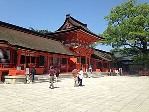
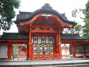
Usa is famous for Usa Jingū, which is the main shrine for over 40,000 Hachiman shrines across Japan. It's a very important historical and religious site.
Contents
Geography of Usa
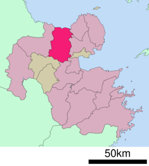
Usa is located at the northern part of the Kunisaki Peninsula. It faces the Gulf of Suō to the north. Other cities and towns surround it.
Three main areas have been important for Usa's economy and culture:
- The Usa district grew around the famous Usa Jingū shrine.
- The Yokkaichi district became a center for Hongan-ji Temple and local government.
- The Nagasu district developed as a busy port town.
Neighboring Cities and Towns
Usa is close to several other places in Ōita Prefecture:
- Beppu
- Bungo-Takada
- Hiji
- Kitsuki
- Kusu
- Nakatsu
- Yufu
Climate in Usa
Usa has a humid subtropical climate. This means it has hot summers and cool winters. It rains a lot throughout the year, but less in winter.
The average yearly temperature in Usa is about 14.9°C (58.8°F). The average rainfall is about 1729.1 mm (68 inches) per year. July is usually the wettest month.
Temperatures are highest in August, around 26.4°C (79.5°F). They are lowest in January, around 4.0°C (39.2°F). The hottest day ever recorded was 37.8°C (100°F) in July 2015. The coldest day was -9.0°C (15.8°F) in February 1981.
| Climate data for Innai, Usa (1991−2020 normals, extremes 1977−present) | |||||||||||||
|---|---|---|---|---|---|---|---|---|---|---|---|---|---|
| Month | Jan | Feb | Mar | Apr | May | Jun | Jul | Aug | Sep | Oct | Nov | Dec | Year |
| Record high °C (°F) | 21.8 (71.2) |
26.1 (79.0) |
27.5 (81.5) |
31.4 (88.5) |
33.0 (91.4) |
35.5 (95.9) |
37.8 (100.0) |
37.6 (99.7) |
35.1 (95.2) |
30.9 (87.6) |
28.4 (83.1) |
24.5 (76.1) |
37.8 (100.0) |
| Mean daily maximum °C (°F) | 9.4 (48.9) |
10.5 (50.9) |
14.2 (57.6) |
19.8 (67.6) |
24.5 (76.1) |
26.8 (80.2) |
30.9 (87.6) |
31.7 (89.1) |
27.6 (81.7) |
22.6 (72.7) |
17.2 (63.0) |
11.7 (53.1) |
20.6 (69.0) |
| Daily mean °C (°F) | 4.0 (39.2) |
4.9 (40.8) |
8.3 (46.9) |
13.4 (56.1) |
18.2 (64.8) |
21.8 (71.2) |
25.8 (78.4) |
26.4 (79.5) |
22.5 (72.5) |
16.7 (62.1) |
11.0 (51.8) |
5.9 (42.6) |
14.9 (58.8) |
| Mean daily minimum °C (°F) | −0.7 (30.7) |
−0.4 (31.3) |
2.5 (36.5) |
7.1 (44.8) |
12.4 (54.3) |
17.6 (63.7) |
21.9 (71.4) |
22.3 (72.1) |
18.5 (65.3) |
11.7 (53.1) |
5.7 (42.3) |
0.9 (33.6) |
10.0 (49.9) |
| Record low °C (°F) | −8.3 (17.1) |
−9.0 (15.8) |
−8.6 (16.5) |
−3.2 (26.2) |
0.7 (33.3) |
6.2 (43.2) |
12.4 (54.3) |
15.0 (59.0) |
5.6 (42.1) |
−0.6 (30.9) |
−3.8 (25.2) |
−7.5 (18.5) |
−9.0 (15.8) |
| Average precipitation mm (inches) | 59.5 (2.34) |
70.7 (2.78) |
106.2 (4.18) |
114.7 (4.52) |
130.5 (5.14) |
302.4 (11.91) |
307.2 (12.09) |
178.5 (7.03) |
220.7 (8.69) |
115.8 (4.56) |
69.0 (2.72) |
53.9 (2.12) |
1,729.1 (68.07) |
| Average precipitation days (≥ 1.0 mm) | 8.4 | 8.7 | 11.2 | 9.9 | 9.3 | 13.7 | 12.6 | 10.1 | 10.8 | 7.5 | 8.0 | 7.6 | 117.8 |
| Mean monthly sunshine hours | 127.5 | 130.2 | 159.0 | 181.7 | 191.4 | 127.8 | 162.7 | 187.8 | 141.9 | 161.1 | 141.7 | 129.0 | 1,841.8 |
| Source: Japan Meteorological Agency | |||||||||||||
Population Changes
The population of Usa has changed over the years. Here's how it has looked since 1950:
| Historical population | ||
|---|---|---|
| Year | Pop. | ±% |
| 1950 | 98,429 | — |
| 1955 | 95,317 | −3.2% |
| 1960 | 87,460 | −8.2% |
| 1965 | 77,025 | −11.9% |
| 1970 | 71,020 | −7.8% |
| 1975 | 67,777 | −4.6% |
| 1980 | 67,811 | +0.1% |
| 1985 | 67,960 | +0.2% |
| 1990 | 65,541 | −3.6% |
| 1995 | 63,819 | −2.6% |
| 2000 | 62,349 | −2.3% |
| 2005 | 60,809 | −2.5% |
| 2010 | 59,015 | −3.0% |
| 2015 | 56,258 | −4.7% |
| 2020 | 52,771 | −6.2% |
| Usa population statistics | ||
History of Usa
The area where Usa is located has a very long history. Its name appears in ancient Japanese books like the Kojiki and Nihon Shoki. Even Emperor Jimmu, a legendary first emperor of Japan, is said to have visited Usa.
Because Usa Jingū was so powerful, no single warrior family could control the area for a long time. It became a battlefield during the Sengoku period (a time of civil war).
Later, during the Edo period, much of Usa was directly controlled by the Japanese government. The modern city of Usa was officially created on April 1, 1967. Over the years, other nearby towns and villages joined Usa.
Usa During World War II
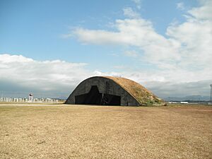
During World War II, Usa had a naval airbase. Japanese planes, including kamikaze planes, flew from here. In 1945, American B-29 bombers attacked the airbase. Many buildings were destroyed, and many people were hurt or died.
You can still see parts of the old airbase today. There are concrete bunkers that once held fighter planes. There's also a large crater called the "bomb pond" from an American bomb.
Economy
Usa's economy is mostly based on agriculture. This means farming is a big part of how people make a living there. The city also has strong business connections with nearby Nakatsu City.
Education
Usa has many schools for children and teenagers:
- 24 public elementary schools
- 7 public junior high schools
- 3 public high schools (run by the Ōita Prefecture)
- 1 private high school
Transportation
Railways
You can travel to and from Usa by train using the JR Kyushu Nippō Main Line.
- Amatsu
- Buzen-Zenkōji
- Yanagigaura
- Buzen-Nagasu
- Usa
- Nishiyashiki
Highways
Major roads that pass through or near Usa include:
 Higashikyushu Expressway
 National Route 10
 National Route 213
 National Route 387
 National Route 500
Local Attractions
Usa has several interesting places to visit:
- Futaba no Sato is a museum about a famous sumo wrestler named Futabayama Sadaji. Outside the museum, there's a statue with the names and handprints of three sumo wrestlers who won many matches.
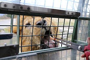
- Kyushu Natural Animal Park African Safari is a huge safari park where you can see many animals. It's located in the Ajimu area of Usa.
- Usa Jingū is a very important shrine that attracts many visitors each year. It's the main shrine for all Hachiman shrines in Japan.
- The Ōita Prefectural Museum of History is also nearby.
Interesting Fact About "Made in USA"
You might have heard a story that products made in Usa, Japan, were labeled "MADE IN USA" to trick people into thinking they were made in the United States. Some even claimed the town changed its name for this reason.
However, these stories are not true. The city has had the name "Usa" for a very long time, long before the 1960s. Also, products imported into the U.S. must clearly state their country of origin. So, it would have been very difficult to use this as a trick.
Notable People from Usa
- Futabayama Sadaji, a very famous sumo wrestler who reached the highest rank of yokozuna.
See also
 In Spanish: Usa (Ōita) para niños
 | William M. Jackson |
 | Juan E. Gilbert |
 | Neil deGrasse Tyson |


