
Utikuma Lake facts for kids
Quick facts for kids Utikuma Lake |
|
|---|---|

Utikuma Lake
Location in Alberta
|
|
| Location | Big Lakes County / Northern Sunrise County, Alberta |
| Coordinates | 55°50′N 115°25′W / 55.833°N 115.417°W |
| Primary outflows | Utikuma River |
| Catchment area | 2,170 km2 (840 sq mi) |
| Basin countries | Canada |
| Max. length | 16.9 km (10.5 mi) |
| Max. width | 27.1 km (16.8 mi) |
| Surface area | 288 km2 (111 sq mi) |
| Average depth | 1.7 m (5 ft 7 in) |
| Max. depth | 5.5 m (18 ft) |
| Surface elevation | 641 m (2,103 ft) |
Utikuma Lake is a big lake found in the middle of northern Alberta, Canada. It's about 30 km (19 mi) north of another lake called Lesser Slave Lake. You can find it between two highways: the Bicentennial Highway and Highway 750.
Contents
Discovering Utikuma Lake's Features
Utikuma Lake covers a large area of 288 km2 (111 sq mi). It's not a very deep lake, with its deepest point being only 5.5 m (18 ft). The lake sits high up, at an elevation of 648 m (2,126 ft) above sea level.
How Water Flows In and Out
The water from Utikuma Lake flows out through the Utikuma River. This river then joins the Wabasca River, and eventually, all that water makes its way to the mighty Peace River.
What Does "Utikuma" Mean?
The name Utikuma comes from the Cree language. In Cree, it means "big whitefish." This name likely refers to the type of fish that live in the lake.
The First Nations Community at the Lake
On the northern shore of Utikuma Lake, there is a special area called Utikoomak Lake 155. This is an indian reserve that belongs to the Whitefish Lake First Nations people. They have lived near this lake for a very long time.
Images for kids
-
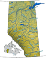
This map shows the rivers and lakes in Alberta, Canada. Utikuma Lake is marked with a pin.

