
Utrechtse Heuvelrug facts for kids
Quick facts for kids
Utrechtse Heuvelrug
|
|||
|---|---|---|---|

Utrecht Hill Ridge
|
|||
|
|||
.svg)
Location in Utrecht
|
|||
| Country | Netherlands | ||
| Province | Utrecht | ||
| Established | 1 January 2006 | ||
| Government | |||
| • Body | Municipal council | ||
| Area | |||
| • Total | 134.09 km2 (51.77 sq mi) | ||
| • Land | 132.24 km2 (51.06 sq mi) | ||
| • Water | 1.85 km2 (0.71 sq mi) | ||
| Elevation | 7 m (23 ft) | ||
| Population
(May 2014)
|
|||
| • Total | 47,903 | ||
| • Density | 362/km2 (940/sq mi) | ||
| Time zone | UTC+1 (CET) | ||
| • Summer (DST) | UTC+2 (CEST) | ||
| Postcode |
3940–3941, 3950–3959, 3970–3972
|
||
| Area code | 0343 | ||

Utrechtse Heuvelrug is a municipality, which is like a local government area, in the Netherlands. It is located in the Utrecht province. This municipality was created on January 1, 2006. It was formed by joining five smaller municipalities: Amerongen, Doorn, Driebergen-Rijsenburg, Leersum, and Maarn.
Contents
What's in the Name?
The name Utrechtse Heuvelrug means "Utrecht Hill Ridge" in English. This name comes from a long line of sandy hills that runs through part of the Utrecht province. All the towns that joined to form this municipality are located on the southern part of these hills.
A special part of these hills is the Utrechtse Heuvelrug National Park. This park covers about 6,000 hectares (which is about 14,800 acres) and was created in 2003. It is a beautiful natural area for everyone to enjoy.
Towns and Villages
The municipality of Utrechtse Heuvelrug includes several towns and villages. These are:
- Amerongen
- Darthuizen
- Doorn
- Driebergen-Rijsenburg
- Leersum
- Maarn
- Maarsbergen
- Overberg

Getting Around
You can travel by train in Utrechtse Heuvelrug. The main railway stations are:
- Driebergen-Zeist
- Maarn
Famous People from Utrechtse Heuvelrug
Many interesting people have lived in or come from the Utrechtse Heuvelrug area. Here are a few:
Public Service and Leaders
- Frederick Nassau de Zuylestein (1624–1672): He was the son of a famous Dutch leader, Prince Frederick Henry. He was given Castle Zuylestein in 1640.
- Wilhelm II, German Emperor (1859–1941): He was the last German Emperor. After his rule ended, he lived in Doorn from 1919 until he passed away in 1941.
- Louis Beel (1902–1977): A Dutch politician who served as the Prime Minister of the Netherlands two times, from 1946 to 1948 and again from 1958 to 1959.
- Ria Beckers (1938–2006): She was a Dutch politician and helped start the GreenLeft political party.
- Ben Verwaayen (born 1952): A Dutch businessman who was the CEO of a big company called Alcatel-Lucent from 2008 to 2013.
Artists and Performers
- Anton van Wouw (1862–1945): A famous sculptor who is known as the father of South African sculpture.
- Aldo van Eyck (1918–1999): An architect known for his unique building designs.
- Gijs Scholten van Aschat (born 1959): A well-known Dutch actor.
- Nicky Romero (born 1989): A Dutch musician, DJ, and record producer who makes electronic music.
Sports Stars
- Jops Reeman (1886–1959): A Dutch football player who won a bronze medal at the 1908 Summer Olympics.
- Gratia Schimmelpenninck van der Oye (1912–2012): A Dutch alpine skier who competed in the 1936 Winter Olympics.
- Nienke Kingma (born 1982): A rower who won a silver medal at the 2008 Summer Olympics and a bronze medal at the 2012 Summer Olympics.
- Claudia Belderbos (born 1985): A Dutch rower who won a bronze medal at the 2012 Summer Olympics.
Gallery
-
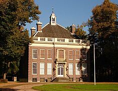
Sparrendaal Driebergen
-
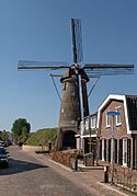
Amerongen, korenmolen Maallust
-
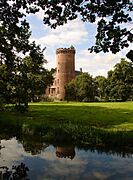
Sterkenburg Castle
-
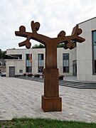
Doorn - Sculptuur for the town hall in Doorn
-
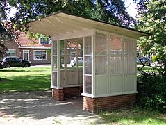
Maarn Tuindorpweg Bushokje
-
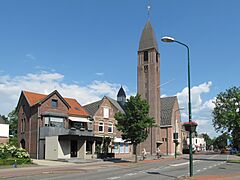
Driebergen, church (de Grote Kerk)
-
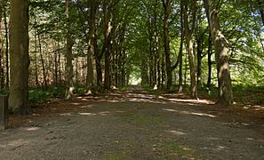
Doorn, heath: the Dartheide


See also
 In Spanish: Utrechtse Heuvelrug para niños
