Valdecebollas facts for kids
Quick facts for kids Valdecebollas |
|
|---|---|
 |
|
| Highest point | |
| Elevation | 2139 m |
| Prominence | 292 m |
| Geography | |
| Location | Spain |
| Parent range | Cantabrian Mountains |
| Geology | |
| Mountain type | Stone |
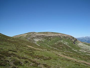
Valdecebollas Peak is a tall mountain in Spain. It is part of the Cantabrian Mountains in a region called Montaña Palentina. This mountain is 2,144 meters (about 7,034 feet) high. It is a well-known peak in the area.
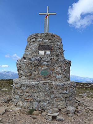
At the very top of Valdecebollas, there is a special stone tower. It is called the "Torreón." This tower has a plaque and a summit book where visitors can write. There is also a triangulation station used for mapping. Since 1965, people have gathered here. A special event, a mass, is held every year on the first Sunday of August. People from nearby towns like Barruelo and Brañosera organize it. Many hikers and climbers from other areas also join in.
Contents
Where is Valdecebollas Located?
Valdecebollas is found near the town of Brañosera. It is in the eastern part of the Montaña Palentina Natural Park. The mountain is about 20 kilometers (12 miles) from Aguilar de Campoo. It is also close to the main highway that connects Cantabria and Meseta. The exact spot is 42°57′59″N 4°21′53″W / 42.966389°N 4.364722°W. This mountain marks the eastern edge of the Montaña Palentina area.
How to Climb Valdecebollas Peak
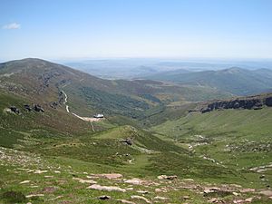
The easiest way to climb Valdecebollas is from the town of Brañosera. You can drive part of the way to a place called El Golobar, which is 1,840 meters high. From El Golobar, you continue on foot. You walk through a pass called Sel de la Fuente. This path leads you to the triangulation station at the top, which is 2,139 meters high.
From the peak, you can see amazing views. You can look out at the Sierra de Peña Labra. You can also see the very tall peaks of Fuentes Carrionas, like Espigüete and Curavacas.
Interesting Facts About Valdecebollas

Valdecebollas is important because it forms the northern side of the Covarrés valley. This valley was carved out by a glacier long ago. The Pisuerga River starts in this area. Water from the glacier basin disappears into a hole called Sel de la Fuente. It then reappears about three kilometers away in the Cueva del Cobre cave. This cave is near the town of Santa María de Redondo. You can also climb Valdecebollas from Santa María de Redondo, but it is a much longer hike.
The plants on this mountain are mostly heather and a type of plant called Mantisalca. On the lower slopes, you can see forests of beech and oak trees. In winter, there is a lot of snow. Beautiful ice waterfalls often form on the mountain's sides.
See also
- El Golobar
- In Spanish: Valdecebollas para niños
 | Janet Taylor Pickett |
 | Synthia Saint James |
 | Howardena Pindell |
 | Faith Ringgold |


