Vandalia, Michigan facts for kids
Quick facts for kids
Vandalia, Michigan
|
|
|---|---|
|
Village
|
|

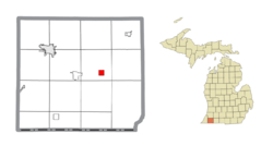
Location within Cass County
|
|
| Country | United States |
| State | Michigan |
| County | Cass |
| Township | Penn |
| Settled | 1848 |
| Incorporated | 1875 (village) |
| Government | |
| • Type | Village council |
| Area | |
| • Total | 0.99 sq mi (2.56 km2) |
| • Land | 0.99 sq mi (2.56 km2) |
| • Water | 0.00 sq mi (0.00 km2) |
| Elevation | 879 ft (268 m) |
| Population
(2020)
|
|
| • Total | 318 |
| • Density | 321.86/sq mi (124.22/km2) |
| Time zone | UTC-5 (Eastern (EST)) |
| • Summer (DST) | UTC-4 (EDT) |
| ZIP code(s) |
49095
|
| Area code(s) | 269 |
| FIPS code | 26-81680 |
| GNIS feature ID | 1615496 |
Vandalia is a small village located in Cass County, Michigan. It's part of Penn Township. In 2020, about 318 people lived there. Vandalia is also part of a larger area called Michiana, which includes cities like South Bend and Mishawaka in Indiana.
Contents
History of Vandalia
The village of Vandalia officially became a village in 1875. This happened thanks to Stephen Bogue and Charles P. Ball. They built a gristmill (a mill that grinds grain into flour) in the area around 1848–1849. This mill helped the settlement grow.
On July 8, 1850, Theron J Wilcox became the first postmaster for the community. Ada Kinsbury is known as the area's first merchant, meaning she ran the first store. In 1871, the Michigan Central Railroad built a train station in Vandalia, which helped the village connect with other places.
Vandalia was an important stop on the Underground Railroad. This was a secret network of safe houses and routes that helped enslaved people escape to freedom. You can find a memorial sign about the Underground Railroad at Milo E. Barnes Park, near M-60. Other places in Penn Township, where Vandalia is located, were also part of this historic network.
Geography of Vandalia
Vandalia is a small village. According to the United States Census Bureau, the village covers about 0.99 square miles (2.56 square kilometers). All of this area is land, with no large bodies of water inside the village limits.
Population and People
| Historical population | |||
|---|---|---|---|
| Census | Pop. | %± | |
| 1880 | 439 | — | |
| 1890 | 423 | −3.6% | |
| 1900 | 407 | −3.8% | |
| 1910 | 371 | −8.8% | |
| 1920 | 331 | −10.8% | |
| 1930 | 373 | 12.7% | |
| 1940 | 360 | −3.5% | |
| 1950 | 360 | 0.0% | |
| 1960 | 357 | −0.8% | |
| 1970 | 427 | 19.6% | |
| 1980 | 447 | 4.7% | |
| 1990 | 357 | −20.1% | |
| 2000 | 429 | 20.2% | |
| 2010 | 301 | −29.8% | |
| 2020 | 318 | 5.6% | |
| U.S. Decennial Census | |||
The population of Vandalia changes over time. In 2010, there were 301 people living in the village. By 2020, the population had grown slightly to 318 people.
The people living in Vandalia come from different backgrounds. In 2010, the village had a mix of White, African American, Native American, and Asian residents, as well as people of two or more races. About 1.7% of the population was Hispanic or Latino.
The average age in the village in 2010 was about 39 years old. About a quarter of the residents were under 18 years old.
Transportation in Vandalia
The main road that goes through Vandalia is M-60. This highway helps connect Vandalia to other towns and cities in Michigan.
Education in Vandalia
Children living in Vandalia attend schools that are part of the Cassopolis Public Schools district.
See also
 In Spanish: Vandalia (Míchigan) para niños
 | Calvin Brent |
 | Walter T. Bailey |
 | Martha Cassell Thompson |
 | Alberta Jeannette Cassell |


