Cass County, Michigan facts for kids
Quick facts for kids
Cass County
|
||
|---|---|---|
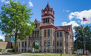
Cass County Courthouse in Cassopolis
|
||
|
||
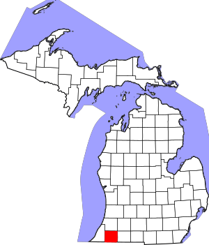
Location within the U.S. state of Michigan
|
||
 Michigan's location within the U.S. |
||
| Country | ||
| State | ||
| Founded | 1829 | |
| Named for | Lewis Cass | |
| Seat | Cassopolis | |
| Largest city | Dowagiac | |
| Area | ||
| • Total | 508 sq mi (1,320 km2) | |
| • Land | 490 sq mi (1,300 km2) | |
| • Water | 18 sq mi (50 km2) 3.6%% | |
| Population
(2020)
|
||
| • Total | 51,589 | |
| • Density | 105/sq mi (41/km2) | |
| Congressional district | 5th | |
Cass County is a county in the state of Michigan. In 2020, about 51,589 people lived here. Its main town, or county seat, is Cassopolis.
Cass County is part of a larger area called the South Bend–Mishawaka Metropolitan Statistical Area. This area includes parts of Indiana and Michigan and is sometimes called the Michiana region.
Contents
History of Cass County
Cass County was created in 1829. It was named after Lewis Cass, who was the governor of the Michigan Territory at that time. He later became an important government official for President Andrew Jackson.
Unlike some other parts of Michigan, Cass County had less dense forests and more open, fertile land called "prairie." This made it a great place for early settlers who wanted to farm, so the population grew quickly.
Industry also started early here. By 1830, a mill was built on Dowagiac Creek. Many early settlers came from Ohio and Indiana, traveling on a path that led from Fort Wayne, Indiana. By 1834, more than 3,000 people lived in Cass County.
Some of the first important settlers were Baldwin Jenkins and Uzziel Putnam. Jenkins came from Ohio because he was against slavery. Putnam also came from Ohio. These families helped start the village of Pokagon in 1825. Another settlement, Edwardsburg, was started in 1826.
The town of Cassopolis was planned in 1831 to be the county seat because it was in the middle of the county. At first, no one lived there.
Black Settlers and the Underground Railroad
After 1840, many Black families moved to Cass County. They were looking for a safe place because many white residents, especially a group called Quakers, were against unfair laws, including those that supported slavery. The land was also affordable. Both free Black people and those who had escaped slavery found a safe home in Cass County.
This growing community caught the attention of slave owners from Kentucky. In 1847 and 1849, they tried to capture people who had escaped slavery in Cass County. However, local farmers, armed with tools, stood up to them and stopped their efforts.
These events helped lead to a new law in 1850 called the Fugitive Slave Act of 1850. This law made it harder for escaped slaves to find freedom and put free Black people at risk. But many people in the North, especially in places like Cass County, continued to resist this law.
Cass County became well-known for its strong anti-slavery views. The Quaker community in Penn Township (started in 1829) became an important stop on the Underground Railroad. This was a secret network that helped people escape slavery to freedom. One route went through Niles, Cassopolis, Schoolcraft, Climax, and Battle Creek.
Geography of Cass County
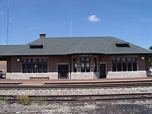
Cass County covers about 508 square miles. Most of this (490 square miles) is land, and about 18 square miles (3.6%) is water. It's the smallest county in Michigan by total area.
Main Roads
 US 12
US 12 M-40
M-40 M-51
M-51 M-60
M-60
 Bus. M‑60
 M-62
M-62- M-152
- M-216
- M-217
Neighboring Counties
- Van Buren County (north)
- St. Joseph County (east)
- Berrien County (west)
- Elkhart County, Indiana (southeast)
- St. Joseph County, Indiana (southwest)
People in Cass County
| Historical population | |||
|---|---|---|---|
| Census | Pop. | %± | |
| 1830 | 919 | — | |
| 1840 | 5,710 | 521.3% | |
| 1850 | 10,907 | 91.0% | |
| 1860 | 17,721 | 62.5% | |
| 1870 | 21,094 | 19.0% | |
| 1880 | 22,009 | 4.3% | |
| 1890 | 20,953 | −4.8% | |
| 1900 | 20,876 | −0.4% | |
| 1910 | 20,624 | −1.2% | |
| 1920 | 20,395 | −1.1% | |
| 1930 | 20,888 | 2.4% | |
| 1940 | 21,910 | 4.9% | |
| 1950 | 28,185 | 28.6% | |
| 1960 | 36,932 | 31.0% | |
| 1970 | 43,312 | 17.3% | |
| 1980 | 49,499 | 14.3% | |
| 1990 | 49,477 | 0.0% | |
| 2000 | 51,104 | 3.3% | |
| 2010 | 52,293 | 2.3% | |
| 2020 | 51,589 | −1.3% | |
| 2023 (est.) | 51,642 | −1.2% | |
| U.S. Decennial Census 1790-1960 1900-1990 1990-2000 2010-2018 |
|||
In 2010, there were 52,293 people living in Cass County. Most people were White (88.9%), with 5.4% Black or African American, and 1.0% Native American. About 3.0% of the population identified as Hispanic or Latino. Many residents have German, English, or Irish family backgrounds.
The average age in the county in 2000 was 38 years old. About 25.5% of the population was under 18.
Education in Cass County
Colleges
Cass County is home to Southwestern Michigan College. This is a public two-year college that is part of Michigan's community college system. It is the largest employer in Cass County.
Libraries
Cass County has several library systems. The Cass District Library is the biggest, with branches in four cities. It serves many townships in the county.
The Dowagiac District Library serves the City of Dowagiac and nearby areas. Marcellus Township also has its own library. Southwestern Michigan College has the Fred Mathews Library on its campus in Dowagiac.
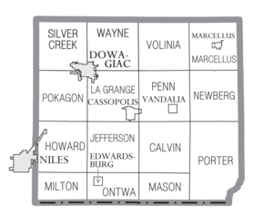
Communities in Cass County
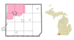
Cities
Villages
- Cassopolis (the county seat)
- Edwardsburg
- Marcellus
- Vandalia
Townships
- Calvin Township
- Howard Township
- Jefferson Township
- LaGrange Township
- Marcellus Township
- Mason Township
- Milton Township
- Newberg Township
- Ontwa Township
- Penn Township
- Pokagon Township
- Porter Township
- Silver Creek Township
- Volinia Township
- Wayne Township
Unincorporated Communities
These are smaller communities that are not officially cities or villages.
- Adamsville
- Calvin Center
- Charleston
- Corey
- Glenwood
- Jones
- La Grange
- Penn
- Pokagon
- Sumnerville
- Union
- Wakelee
Indian Reservation
Cass County is home to a large part of the Pokagon Band of Potawatomi Indians reservation. Their main office is in Dowagiac. The reservation also extends into other nearby townships and even into Indiana.
See also
 In Spanish: Condado de Cass (Míchigan) para niños
 | Delilah Pierce |
 | Gordon Parks |
 | Augusta Savage |
 | Charles Ethan Porter |


