Vavuniya facts for kids
Quick facts for kids
Vavuniya
|
|
|---|---|
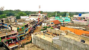
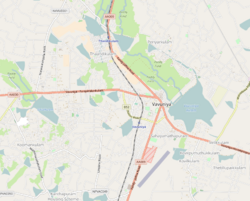
Partial aerial view of Vavuniya
|
|
| Country | Sri Lanka |
| Province | Northern |
| District | Vavuniya |
| DS Division | Vavuniya South (Tamil) |
| Government | |
| • Type | Municipal Council |
| Area | |
| • Land | 2,248.96 ha (5,557.30 acre) |
| Elevation | 200 m (700 ft) |
| Demonym(s) |
|
| Time zone | UTC+5:30 (Sri Lanka Standard Time Zone) |
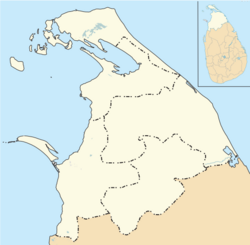
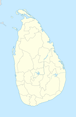
Vavuniya (Tamil: வவுனியா, Romanized: Vavuniya, Sinhala: වවුනියාව, Romanized: Vavuniyāva) is a city in the Vavuniya District of the Northern Province in Sri Lanka. A local council manages the city.
Vavuniya has been known for a very long time. It used to be a heavily forested area. Before the Sri Lankan Civil War, fewer than 100,000 people lived in the whole district. The city sits on a border, separating areas where Tamil people mostly live from areas where Sinhalese people mostly live. South of Vavuniya are Sinhala cities, and to its north are Tamil cities. The city has many Tamils and Muslims, plus a good number of Sinhalese people. In the past, Vavuniya was called Vanni because there were many Vanni Trees (Prosopis cineraria) there. The main military base for the Wanni region is also in Vavuniya.
Contents
History of Vavuniya
This city has a long and interesting history. Ancient Sinhala kings once ruled here. They built many large water tanks to store water. Near these tanks, they placed special "Naga Sacred Guard Stones" with carvings on them. These kings took over the city from the ancient Yaka and Naga people of Sri Lanka.
Vavuniya's Climate
Vavuniya has a tropical savanna climate. This means it's warm to hot all year round. It also has a clear wet season from October to December. Temperatures are a bit cooler from November to February compared to the rest of the year.
| Climate data for Vavuniya (1991–2020) | |||||||||||||
|---|---|---|---|---|---|---|---|---|---|---|---|---|---|
| Month | Jan | Feb | Mar | Apr | May | Jun | Jul | Aug | Sep | Oct | Nov | Dec | Year |
| Record high °C (°F) | 34.0 (93.2) |
36.0 (96.8) |
38.8 (101.8) |
40.1 (104.2) |
38.8 (101.8) |
38.5 (101.3) |
38.8 (101.8) |
38.4 (101.1) |
39.1 (102.4) |
38.1 (100.6) |
35.0 (95.0) |
33.0 (91.4) |
40.1 (104.2) |
| Mean daily maximum °C (°F) | 29.9 (85.8) |
31.5 (88.7) |
34.3 (93.7) |
34.9 (94.8) |
34.3 (93.7) |
34.4 (93.9) |
34.7 (94.5) |
34.6 (94.3) |
34.5 (94.1) |
32.6 (90.7) |
30.6 (87.1) |
29.6 (85.3) |
33.0 (91.4) |
| Daily mean °C (°F) | 25.5 (77.9) |
26.4 (79.5) |
28.4 (83.1) |
29.5 (85.1) |
29.7 (85.5) |
29.8 (85.6) |
29.9 (85.8) |
29.7 (85.5) |
29.6 (85.3) |
28.2 (82.8) |
26.7 (80.1) |
25.8 (78.4) |
28.3 (82.9) |
| Mean daily minimum °C (°F) | 20.9 (69.6) |
21.1 (70.0) |
22.4 (72.3) |
24.0 (75.2) |
25.0 (77.0) |
25.1 (77.2) |
24.9 (76.8) |
24.7 (76.5) |
24.4 (75.9) |
23.6 (74.5) |
22.7 (72.9) |
21.9 (71.4) |
23.4 (74.1) |
| Record low °C (°F) | 12.4 (54.3) |
10.5 (50.9) |
13.4 (56.1) |
15.3 (59.5) |
17.8 (64.0) |
18.8 (65.8) |
18.2 (64.8) |
18.2 (64.8) |
18.5 (65.3) |
16.0 (60.8) |
16.5 (61.7) |
13.0 (55.4) |
10.5 (50.9) |
| Average precipitation mm (inches) | 107.0 (4.21) |
76.2 (3.00) |
43.1 (1.70) |
123.1 (4.85) |
95.4 (3.76) |
21.1 (0.83) |
36.9 (1.45) |
63.9 (2.52) |
88.7 (3.49) |
230.0 (9.06) |
276.0 (10.87) |
249.1 (9.81) |
1,410.5 (55.53) |
| Average precipitation days (≥ 1.0 mm) | 7.1 | 4.7 | 3.9 | 9.2 | 5.8 | 2.1 | 2.6 | 4.1 | 5.7 | 13.3 | 17.1 | 12.5 | 88.0 |
| Source: NOAA | |||||||||||||
People of Vavuniya
The Northern Province, where Vavuniya is located, has about 1.246 million people. It's the province with the fewest people in Sri Lanka. Most people (84.5%) live in rural areas, while only 15.5% live in cities.
About 89% of the people in the province are Sri Lankan Tamils. Other groups include Sri Lankan Moors, Sinhalese, and Indian Tamils. Most Sri Lankan Tamils are Hindus. There are also Christians, Muslims, and a small number of Buddhists.
The chart below shows the different groups of people living in Vavuniya. You can see that the city's population mix is very similar to that of the whole Vavuniya district.
Sri Lankan Tamils (84.30%) Sri Lankan Moors (8.22%) Sinhalese (6.52%) Indian Tamils (0.93%)
City Areas (Wards)
Vavuniya is divided into different areas called wards. Each ward has its own number and name:
| Ward Number | Area |
|---|---|
| 1 | Thandikkulam |
| 2 | Paddanichipuliyankulam |
| 3 | Pandarikulam |
| 4 | Vairavarpuliyankulam |
| 5 | Kudiyiruppu |
| 6 | Kadai Veethi |
| 7 | Moondru Muripu |
| 8 | Rambaikulam |
| 9 | Sinnaputhukkulam |
| 10 | Kovilkulam |
Getting Around Vavuniya
Vavuniya has good transport links. The Vavuniya railway station is on the Northern Line. This train line connects Kankesanthurai in the north all the way to Colombo. During the Sri Lankan civil war, Vavuniya was the end of the Northern Line.
There is also the Vavuniya airport. It is used as an air force base and also for local flights. Vavuniya is right in the middle of the Vanni region. It acts as a gateway, making it easy to reach all the northern cities quickly.
Education in Vavuniya
Vavuniya is split into four main areas for education. These are Vavuniya North, Vavuniya South, Vavuniya South-Sinhala division, and Chettikulam. Vavuniya City itself is part of the Vavuniya South Division.
See also
 In Spanish: Vavuniya para niños
 | Dorothy Vaughan |
 | Charles Henry Turner |
 | Hildrus Poindexter |
 | Henry Cecil McBay |


